Near Winchester in Frederick County, Virginia — The American South (Mid-Atlantic)
The Third Battle of Winchester
Confederate Horse Artillery
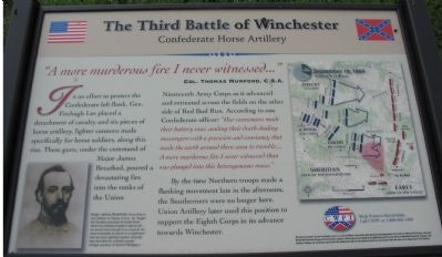
"A more murderous fire I never witnessed..."Col. Thomas Munford, C.S.A.
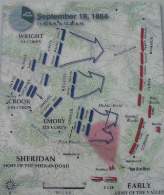
In an effort to protect the Confederate left flank, Gen. Fitzhugh Lee placed a detachment of cavalry and six pieces of horse artillery, lighter cannons made specifically for horse soldiers, along this rise. These guns, under the command of Major James Breathed, poured a devastating fire into the ranks of the Union Nineteenth Army Corps as it advanced and retreated across the fields on the other side of Red Bud Run. According to one Confederate officer: "Our cannoneers made their battery roar, sending their death-dealing messengers with a precision and consistency that made the earth around them seem to tremble....A more murderous fire I never witnessed than was plunged into this heterogeneous mass."
By the time Northern troops made a flanking movement late in the afternoon, the Southerners were no longer here. Union Artillery later used this position to support the Eighth Corps in its advanced towards Winchester.
Erected by Civil War Preservation Trust.
Topics. This historical marker is listed in this topic list: War, US Civil.
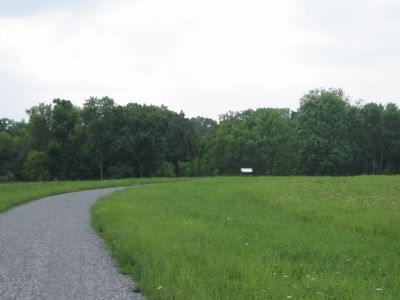
Location. Marker has been reported permanently removed. It was located near 39° 12.253′ N, 78° 7.56′ W. Marker was near Winchester, Virginia, in Frederick County. Marker could be reached from Redbud Road (County Route 661), on the right when traveling east. Located at the Confederate Horse Artillery Wayside, along the Confederate Flank Trail, inside the CWPT Third Winchester Battlefield site. The closest trailhead to this marker is along Redbud Road. Touch for map. Marker was in this post office area: Winchester VA 22603, United States of America.
We have been informed that this sign or monument is no longer there and will not be replaced. This page is an archival view of what was.
Other nearby markers. At least 8 other markers are within walking distance of this location. Duval's Attack (within shouting distance of this marker); Ohio (within shouting distance of this marker); Stuck In The Mud (about 300 feet away, measured in a direct line); In Memory of Gilcin F. Meadors III (about 600 feet away); Sheridan Renews The Attack (about 700 feet away); Fury On The Fence Line (about 700 feet away); A Murderous Fire (approx. 0.2 miles away); Hackwood And Patton (approx. 0.2 miles away). Touch for a list and map of all markers in Winchester.
More about this marker. On the lower right is a portrait of Major James Breathed. "According

Photographed By Craig Swain, August 26, 2007
2. Detail of the Map
Take a Virtual Tour by Markers of the CWPT's Third Winchester Battlefield:
Click for more information.
Click for more information.
Also see . . .
1. Major James Breathed. Antietam on the Web entry:
A physician by trade, Breathed joined Stuart's cavalry by way of chance encounter as an artillerist. He served through the war, seeing action in most of the major battles of the Eastern Theater. (Submitted on October 22, 2007, by Craig Swain of Leesburg, Virginia.)
2. Summary of the Battle of Third Winchester. The action described on the marker is covered under phase 4 of this National Parks Service summary. (Submitted on October 27, 2007, by Craig Swain of Leesburg, Virginia.)
Credits. This page was last revised on October 20, 2023. It was originally submitted on October 22, 2007, by Craig Swain of Leesburg, Virginia. This page has been viewed 2,475 times since then and 23 times this year. Photos: 1, 2, 3. submitted on October 22, 2007, by Craig Swain of Leesburg, Virginia.

