Park Slope in Brooklyn in Kings County, New York — The American Northeast (Mid-Atlantic)
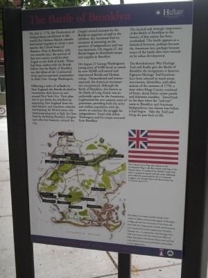
The Battle of Brooklyn
Revolutionary War Heritage Trail
Following a series of setbacks in New England, the British decided to concentrate their forces in and around New York City. Their plan was to put down the rebellion by separating New England from the mid-Atlantic and Southern colonies. Anticipating the British move, the Americans prepared to fight for New York by fortifying Brooklyn Heights and other key locations around the city.
Despite several attempts by the British to negotiate an end to the rebellion, the Americans had no intention of retreating on the question of independence and war was imminent. On August 22, the British began to disembark troops and supplies in Brooklyn.
On August 27 George Washington’s young army of 9,000 faced an attack by over 20,000 well-armed and experienced British and Hessian troops. Outnumbered and outmaneuvered, the American resistance was overpowered. Although the Battle of Brooklyn, also known as the Battle of Long Island, was an undeniable upset for the Americans, it galvanized the new nation’s sense of patriotism, providing both the army and civilian population with the resolve to continue the struggle for independence. Faced with defeat Washington and his troops retreated from Brooklyn.
The tactical and strategic importance of the Battle of Brooklyn to the history of this nation has been overlooked. The battle appears as a historical footnote, perhaps because the Americans lost, perhaps because many of the battle sites were overtaken by urban development.
The Revolutionary War Heritage Trail will finally give the Battle of Brooklyn the recognition it deserves. Eighteen Heritage Trail locations have been selected to mark troop movements, skirmishes, and other actions of the summer of 1776, a time when Kings County consisted of farms, dense forest, oyster ponds and tidewater marshes. Travel back to the days when the “redcoats” came to Brooklyn and American Independence was almost lost before it had begun. Take the Trail and bring the past back to life.
This project was made possible thanks to the combined efforts and financial support of Brooklyn College and the City University of New York, the New York City Department of Parks and Recreation and a local not-for-profit organization, Brooklyn Heritage, Inc., in
conjunction with Heritage, New York, a division of the New York State Office of Parks, recreation and Historic Preservation and the cooperation of numerous individuals and local historical organizations.
Erected by State of New York.
Topics. This historical marker is listed in this topic list: War, US Revolutionary. A significant historical date for this entry is July 4, 1776.
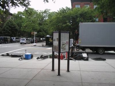
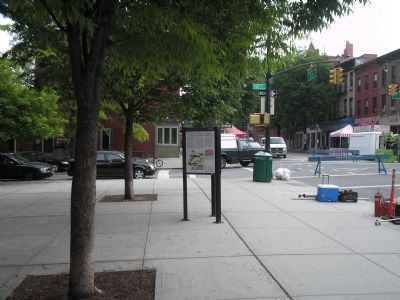
Location. 40° 40.365′ N, 73° 59.008′ W. Marker is in Brooklyn, New York, in Kings County. It is in Park Slope. Marker is at the intersection of 5th Avenue and 3rd Street, on the right when traveling south on 5th Avenue. Marker is located at the eastern entrance to J.J. Byrne Park. Touch for map. Marker is in this post office area: Brooklyn NY 11215, United States of America. Touch for directions.
Other nearby markers. At least 8 other markers are within walking distance of this marker. The Old Stone House (here, next to this marker); a different marker also named Old Stone House (within shouting distance of this marker); Maryland Regiment Burial Site (approx. 0.4 miles away); Maryland Heroes (approx. 0.4 miles away); Carroll Street Bridge (approx. half a mile away); Brooklyn Society for Ethical Culture (approx. 0.6 miles away); Major General Gouverneur Kemble Warren (approx. 0.7 miles away); The Marquis de Lafayette (approx. 0.7 miles away). Touch for a list and map of all markers in Brooklyn.
More about this marker. The bottom left of the marker contains a map of Brooklyn indicating the different Heritage Trail sites relating to the Battle of Brooklyn. The right of the marker features a picture of “The Grand Union Flag, also known as the Continental Flag, [was] the first widely used flag of the United States. It combined the British Union Jack with 13 stripes to signify colonial unity. Although never officially sanctioned by the Continental Congress, the Grand Union was flown from late 1775 until mid 1777.”
Also see . . .
1. The Battle of Long Island, August 27, 1776 at Long Island, New York. The American Revolutionary War website. (Submitted on May 21, 2010, by Bill Coughlin of Woodland Park, New Jersey.)
2. Battle of Long Island, August 27, 1776. (Submitted on May 21, 2010, by Bill Coughlin of Woodland Park, New Jersey.)
3. The Battle of Long Island 1776. A British perspective of the battle from BritishBattles.com. (Submitted on May 21, 2010, by Bill Coughlin of Woodland Park, New Jersey.)
Credits. This page was last revised on January 31, 2023. It was originally submitted on May 21, 2010, by Bill Coughlin of Woodland Park, New Jersey. This page has been viewed 945 times since then and 13 times this year. Photos: 1, 2, 3. submitted on May 21, 2010, by Bill Coughlin of Woodland Park, New Jersey.


