Chelmsford in Middlesex County, Massachusetts — The American Northeast (New England)
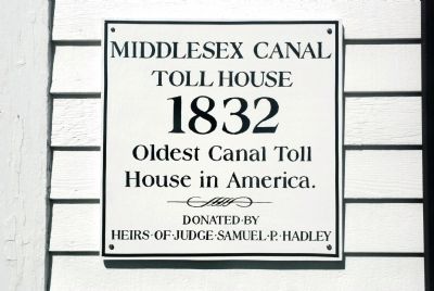
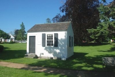
Oldest Toll House
Erected by Heirs of Judge Samuel P. Hadley.
Topics. This historical marker is listed in these topic lists: Industry & Commerce • Waterways & Vessels. A significant historical year for this entry is 1832.
Location. 42° 35.891′ N, 71° 21.169′ W. Marker is in Chelmsford, Massachusetts, in Middlesex County. Marker is on North Road (Massachusetts Route 4), on the left when traveling north. Touch for map. Marker is in this post office area: Chelmsford MA 01824, United States of America. Touch for directions.
Other nearby markers. At least 8 other markers are within 4 miles of this marker, measured as the crow flies. First School for Lip-Reading (a few steps from this marker); Revolutionary War Monument (within shouting distance of this marker); District No. 1 School (about 300 feet away, measured in a direct line); Chelmsford (about 500 feet away); Chelmsford’s “Minuteman Boulder” (about 600 feet away); Soldiers and Sailors Monument (approx. 2.8 miles away); Chief of the Penacooks (approx. 2.8 miles away); a different marker also named Chelmsford (approx. 3.1 miles away). Touch for a list and map of all markers in Chelmsford.
More about this marker. The house and marker are located in Penham Park.
Regarding Oldest Toll House. Between 1802 and 1851, the Middlesex Canal linked the Merrimack River at Lowell with other locations as far away as the Boston suburb of Charlestown, a 27-mile stretch. Horse-drawn barges transported grain and lumber along it, while small boats carried passengers. Eventually, railroads rendered the canal obsolete.
The toll house originally stood 3 miles northwest of its present location, where the Middlesex Canal intersected the Merrimack River in Lowell. In the 1970s, heirs of Lowell canal buff Samuel P. Hadley
donated the quaint building to the town of Chelmsford. During summers since the mid-1990s it has been used as an information booth for visitors to Chelmsford.
Also see . . . Wikipedia entry. The story of the Middlesex Canal. (Submitted on May 26, 2010, by Roger W. Sinnott of Chelmsford, Massachusetts.)
Credits. This page was last revised on October 16, 2020. It was originally submitted on May 26, 2010, by Roger W. Sinnott of Chelmsford, Massachusetts. This page has been viewed 1,553 times since then and 28 times this year. Photos: 1, 2. submitted on May 26, 2010, by Roger W. Sinnott of Chelmsford, Massachusetts. • Bill Pfingsten was the editor who published this page.

