Morehead City in Carteret County, North Carolina — The American South (South Atlantic)
Carolina City
A Favorite Resort Stop
— Burnside Expedition —
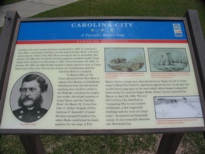
In March 1862, as U.S. forces advanced from New Bern to capture Fort Macon, a Confederate detachment from the fort burned anything that would be useful to the Federals, including the turpentine works, the winter quarters at Camp Vance, and the Carolina Hotel. On March 22, Union Gen. John G. Parke's brigade of Gen. Ambrose E. Burnside's Coastal Division occupied Carolina City, where Parke established his headquarters for the siege of Fort Macon. Parke's troops were then ferried across Bogue Sound to a base camp at Hoop Pole Creek for operations against the fort. A rail spur line carried heavy siege guns to the town wharf, where barges transported them across the sound to Bogue Banks. Parke's forces captured Fort Macon on April 26, 1862. The war left Carolina City, described as "containing fifty to one hundred inhabitants, a few respectable dwellings and the ruins of a large hotel," devastated and financially ruined. It was eventually absorbed into Morehead City.
Erected by North Carolina Civil War Trails.
Topics. This historical marker is listed in this topic list: War, US Civil. A significant historical month for this entry is January 1941.
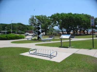
Location. 34° 43.421′ N, 76° 45.065′ W. Marker is in Morehead City, North Carolina, in Carteret County. Marker can be reached from Arendell Street (U.S. 70) west of Taylor STreet, on the right when traveling east. Located at the Crystal Coast Visitor Center. Touch for map. Marker is at or near this postal address: 3409 Arendell St, Morehead City NC 28557, United States of America. Touch for directions.
Other nearby markers. At least 8 other markers are within walking distance of this marker. Camp Glenn (about 300 feet away, measured in a direct line); Atlantic Intracoastal Waterway (about 500 feet away); Siege of Fort Macon (about 500 feet away); a different marker also named Carolina City (about 700 feet away); a different marker also named Carolina City (about 800 feet away); A United States Naval Section Base Inshore Patrol (approx. 0.2 miles away); North Carolina National Guard (approx. 0.2 miles away); N.C. State Highway Patrol (approx. 0.2 miles away). Touch for a list and map of all markers in Morehead City.
More about this marker. On the lower left is a portrait of Gen. Parke. On the right are a set of sketches. Two of these, drawn by Corporal Joseph E. Shadeck, 8th Connecticut Infantry, show Carolina City and Chimneys of burned Camp Vance. The last sketch, on the lower right, shows Carolina City looking East, spur railroad and town wharf in the distance at the right.
Credits. This page was last revised on June 12, 2023. It was originally submitted on May 29, 2010, by Craig Swain of Leesburg, Virginia. This page has been viewed 1,330 times since then and 81 times this year. Photos: 1, 2. submitted on May 29, 2010, by Craig Swain of Leesburg, Virginia. 3. submitted on May 28, 2010, by Craig Swain of Leesburg, Virginia.


