Near Farmville in Prince Edward County, Virginia — The American South (Mid-Atlantic)
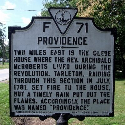
Providence
Erected 1929 by Conservation & Development Commission. (Marker Number F-71.)
Topics and series. This historical marker is listed in these topic lists: Churches & Religion • War, US Revolutionary. In addition, it is included in the Virginia Department of Historic Resources (DHR) series list. A significant historical month for this entry is July 1781.
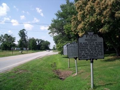
Location. 37° 13.761′ N, 78° 26.55′ W. Marker is near Farmville, Virginia, in Prince Edward County. Marker is at the intersection of Farmville Road (U.S. 15) and Worsham Road (County Route 665), on the right when traveling north on Farmville Road. Touch for map. Marker is in this post office area: Farmville VA 23901, United States of America. Touch for directions.
Other nearby markers. At least 8 other markers are within 2 miles of this marker, measured as the crow flies. Campaign of 1781 (here, next to this marker); History of Worsham (a few steps from this marker); Randolph-Macon Medical School (approx. 0.6 miles away); Slate Hill Plantation (approx. 0.8 miles away); The Beneficial Benevolent Society of the Loving Sisters and Brothers of Hampden County (approx. one mile away); Kingsville (approx. 1.1 miles away); French's Church (approx. 1.1 miles away); The Birthplace (approx. 1.2 miles away). Touch for a list and map of all markers in Farmville.
Credits. This page was last revised on June 16, 2016. It was originally submitted on May 31, 2010, by Bernard Fisher of Richmond, Virginia. This page has been viewed 686 times since then and 22 times this year. Photos: 1, 2. submitted on May 31, 2010, by Bernard Fisher of Richmond, Virginia.

