Near Rockingham in Richmond County, North Carolina — The American South (South Atlantic)
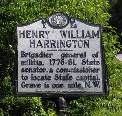
Henry William Harrington
Erected 1948 by North Carolina Archives, Conservation, and Highway Department. (Marker Number K-28.)
Topics and series. This historical marker is listed in these topic lists: Cemeteries & Burial Sites • War, US Revolutionary. In addition, it is included in the North Carolina Division of Archives and History series list.
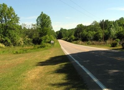
Location. 34° 51.828′ N, 79° 50.226′ W. Marker is near Rockingham, North Carolina, in Richmond County. Marker is at the intersection of U.S. 1 and Osborne Road (North Carolina Highway 1104), on the left when traveling south on U.S. 1. Touch for map. Marker is in this post office area: Rockingham NC 28379, United States of America. Touch for directions.
Other nearby markers. At least 8 other markers are within 6 miles of this marker, measured as the crow flies. Pee Dee Meeting (approx. 3.4 miles away); Sherman's March (approx. 4.9 miles away); North Carolina / South Carolina (approx. 4.9 miles away); Pegues Place / Revolutionary Cartel (approx. 5.3 miles away in South Carolina); Richmond County Veterans Memorial (approx. 6 miles away); Richmond County Korean War Memorial (approx. 6 miles away); Richmond County Vietnam War Memorial (approx. 6 miles away); World War II Memorial (approx. 6 miles away). Touch for a list and map of all markers in Rockingham.
Also see . . . Google Books: Biographical history of North Carolina By Samuel A'Court Ashe. (Submitted on June 4, 2010, by PaulwC3 of Northern, Virginia.)
Credits. This page was last revised on November 29, 2019. It was originally submitted on June 4, 2010, by PaulwC3 of Northern, Virginia. This page has been viewed 1,217 times since then and 5 times this year. Photos: 1, 2. submitted on June 4, 2010, by PaulwC3 of Northern, Virginia.
Editor’s want-list for this marker. Photo of grave site (1- Go south from Rockingham on US # 1. --you will cross over the #74 bypass of Rockingham & Hamlet • 2- Continue for approximately one mile, turn right on paved road to Cordova. • 3- As you approach Cordova bear left and you will run into state road #1103 • 4- Bear left on state road #l103 and you will pass Diggs Chapel Church on your right • 5- Continue past Diggs Chapel Church for about 3/4 or 1 mile, and on right will notice an unpaved road with a chain blocking entrance. • 6-Park car here & walk about 3/4 mile down this unpaved road and two large poplar trees can be seen off to the left. The Harrington Cemetery is at the Poplar trees.) • Can you help?

