Blenheim in Marlboro County, South Carolina — The American South (South Atlantic)
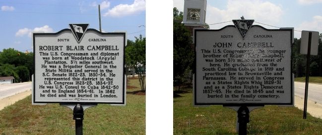
Robert Blair Campbell / John Campbell
This U.S. Congressman and diplomat was born at Woodstock (Argyle) Plantation, 3 ½ miles southwest. He was a Brigadier General in the State Militia and served in the S.C. Senate 1822-23, 1830-34. He represented this district in the U.S. Congress 1823-25, 1834-37. He was U.S. Consul to Cuba 1842-50 and to England 1854-61. In 1862 he died and was buried in London.
Marker Reverse:
This U.S. congressman, the younger brother of Robert Blair Campbell, was born 3 ½ miles southwest of here. He graduated from the South Carolina College in 1819 and practiced law in Brownsville and Parnassus. He served in Congress as a States Rights Whig 1829-31 and as a States Rights Democrat 1837-45. He died in 1845 and was buried in the family cemetery.
Erected 1972 by Marlboro County Historic Preservation Commission. (Marker Number 35-10.)
Topics. This historical marker is listed in this topic list: Cemeteries & Burial Sites. A significant historical year for this entry is 1862.
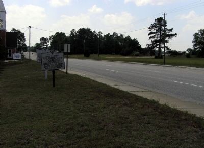
Location. 34° 30.622′ N, 79° 39.173′ W. Marker is in Blenheim, South Carolina, in Marlboro County. Marker is at the intersection of South Main Street (State Highway 38) and East High Street (State Highway 381) on South Main Street. Touch for map. Marker is in this post office area: Blenheim SC 29516, United States of America. Touch for directions.
Other nearby markers. At least 8 other markers are within 7 miles of this marker, measured as the crow flies. Blenheim (here, next to this marker); Battle of Hunt's Bluff / Old River Road (approx. 4.1 miles away); Brownsville Baptist Church (approx. 4.9 miles away); Blenheim Mineral Springs (approx. 5.1 miles away); Brownsville Church (approx. 5.8 miles away); Grave of Mason Lee / Will of Mason Lee (approx. 6.3 miles away); Frederick Charles Hans Bruno Poellnitz / Ragtown (approx. 6.4 miles away); Barnabas Kelet Henagan Home Site (approx. 6.6 miles away). Touch for a list and map of all markers in Blenheim.
Credits. This page was last revised on September 18, 2020. It was originally submitted on June 7, 2010, by PaulwC3 of Northern, Virginia. This page has been viewed 1,183 times since then and 29 times this year. Photos: 1, 2. submitted on June 7, 2010, by PaulwC3 of Northern, Virginia.

