Woodville in Sandusky County, Ohio — The American Midwest (Great Lakes)
Milestones
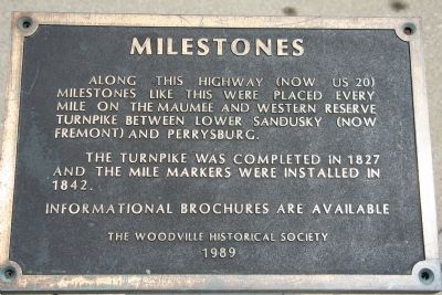
Along this highway (now US 20) milestones like this were placed every mile on the Maumee and Western Reserve Turnpike between Lower Sandusky (now Fremont) and Perrysburg.
The turnpike was completed in 1827 and the mile markers were installed in 1842.
Informational Brochures are Available.
Erected 1989 by The Woodville Historical Society.
Topics. This historical marker is listed in these topic lists: Industry & Commerce • Landmarks • Roads & Vehicles. A significant historical year for this entry is 1827.
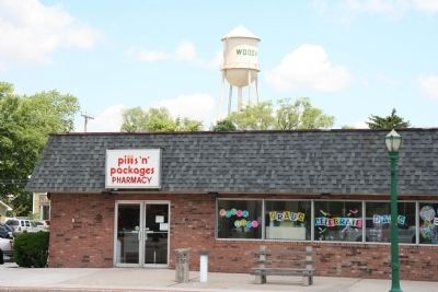
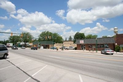
Location. 41° 27.024′ N, 83° 21.774′ W. Marker is in Woodville, Ohio, in Sandusky County. Marker is on East Main Street (U.S. 20) east of North Walnut Street, on the right when traveling west. This historical marker is located in the very heart of downtown Woodville, in the business district, in front of a pharmacy, on the north side of the roadway. It has a historic mile marker situated right beside it. Touch for map. Marker is at or near this postal address: 126 East Main Street, Woodville OH 43469, United States of America. Touch for directions.
Other nearby markers. At least 8 other markers are within walking distance of this marker. Phyllis C. Schnoor Ameling (within shouting distance of this marker); Colonel Charles L. Meyer (about 500 feet away, measured in a direct line); Woodville World War I Memorial (about 500 feet away); Woodville “The Lime Center of the World” / Maumee and Western Reserve Turnpike (about 500 feet away); Town Hall Bell (about 600 feet away); POW-MIA Memorial (about 800 feet away); Christopher C. Layman Law Office (approx. 0.2 miles away); Solomon Lutheran School (approx. 0.2 miles away). Touch for a list and map of all markers in Woodville.
More about this marker. Just a few blocks to the west of this historical marker, and on the other side of the street (in front of the police station) is a State of Ohio historical marker that features the village of Woodville on one side of it and more detailed information regarding the Maumee Western Reserve Turnpike on the other side of the marker.
Related marker. Click here for another marker that is related to this marker. To better understand the relationship, study each marker in the order shown.
Photographed By Dale K. Benington, June 7, 2010
2. Milestones Marker
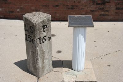
View of historical marker at its location adjacent to the old turnpike milestone marker. The "P" on the right side of the milestone marker tells us that we are 16 miles east of Perrysburg. The "LS" on the left side of the marker tells us that we are 15 miles west of Lower Sandusky (Fremont).
Credits. This page was last revised on June 27, 2022. It was originally submitted on June 8, 2010, by Dale K. Benington of Toledo, Ohio. This page has been viewed 814 times since then and 14 times this year. Last updated on June 18, 2022, by J.T. Lambrou of New Boston, Michigan. Photos: 1, 2, 3, 4, 5. submitted on June 8, 2010, by Dale K. Benington of Toledo, Ohio. • Devry Becker Jones was the editor who published this page.
