Near Shabbona in DeKalb County, Illinois — The American Midwest (Great Lakes)
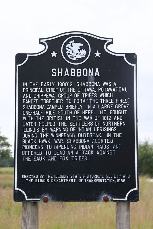
Shabbona
Erected 1986 by Illinois State Historical Society and The Illinois Department of Transportation.
Topics and series. This historical marker is listed in these topic lists: Native Americans • Settlements & Settlers • War of 1812 • Wars, US Indian. In addition, it is included in the Black Hawk War, and the Illinois State Historical Society series lists. A significant historical year for this entry is 1812.
Location. 41° 46.073′ N, 88° 51.73′ W. Marker is near Shabbona, Illinois, in DeKalb County. Marker is at the intersection of East Comanche Avenue (Illinois Route 30) and Indian Road, on the right when traveling east on East Comanche Avenue. Touch for map. Marker is at or near this postal address: 602 East Comanche Avenue, Shabbona IL 60550, United States of America. Touch for directions.
Other nearby markers. At least 8 other markers are within 12 miles of this marker, measured as the crow flies. Chief Shabbona (approx. 0.9 miles away); Bicentennial Grove (approx. 8 miles away); Homes of Chief Waubonsie and Madeline Ogee (approx. 8.3 miles away); Old Chicago Trail (approx. 8.4 miles away); Malta (approx. 11.3 miles away); Lincoln Highway Seedling Mile (approx. 11.7 miles away); Illinois Lincoln Highway (approx. 11.7 miles away); Lincoln Highway (approx. 11.7 miles away).
Also see . . . Shabbona. Wikipedia biographical link including a lot of Northwest (central U.S. NW) history. (Submitted on July 18, 2011, by Chris English of Phoenix, Arizona.)
Credits. This page was last revised on August 22, 2022. It was originally submitted on July 28, 2008, by Kathy Walker of Stafford, Virginia. This page has been viewed 2,819 times since then and 29 times this year. Last updated on June 8, 2010, by William J. Toman of Green Lake, Wisconsin. Photo 1. submitted on August 21, 2022, by Trevor L Whited of Kokomo, Indiana. • Kevin W. was the editor who published this page.
Editor’s want-list for this marker. A wide shot of the marker in context. • Can you help?
