Near Camp Douglas in Monroe County, Wisconsin — The American Midwest (Great Lakes)
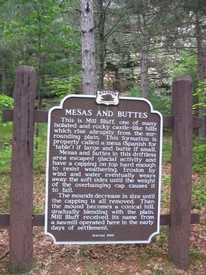
Mesas and Buttes
Mesas and buttes in this driftless area escaped glacial activity and have a capping on top hard enough to resist weathering. Erosion by wind and water eventually wears away the soft sides until the weight of the overhanging cap causes it to fall.
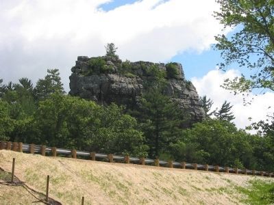
The mounds decrease in size until the capping is all removed. Then the mound becomes a conical hill, gradually blending with the plain. Mill Bluff received its name from a sawmill operated here in the early days of settlement.
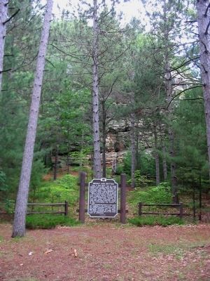
Erected 1963 by the Wisconsin Historical Society. (Marker Number 124.)
Topics and series. This historical marker is listed in these topic lists: Natural Features • Settlements & Settlers. In addition, it is included in the Wisconsin Historical Society series list.
Location. 43° 56.37′ N, 90° 19.01′ W. Marker is near Camp Douglas, Wisconsin, in Monroe County. Marker can be reached from Funnel Road north of U.S. 12, on the right when traveling north. Marker is in Mill Bluff State Park; admission fee charged. Touch for map. Marker is at or near this postal address: 15819 Funnel Road, Camp Douglas WI 54618, United States of America. Touch for directions.
Other nearby markers. At least 8 other markers are within 10 miles of this marker, measured as the crow flies. Ice Age National Scientific Reserve (about 700 feet away, measured in a direct line); Wisconsin Winnebago Veterans Monument (approx. 2.8 miles away); In memory of 1st Lt. Jerome A. Volk (approx. 2.8 miles away); Wisconsin Military Reservation (approx. 3 miles away); Castle Rock (approx. 3.1 miles away); New Lisbon Civil War Memorial (approx. 8.8 miles away); Robert Howie (approx. 9.6 miles away); Tomah (approx. 10 miles away). Touch for a list and map of all markers in Camp Douglas.
Also see . . . Mill Bluff State Park. Wikipedia entry. "There are 10 named bluffs in the park. Mill Bluff, 120 feet (37 m) high, is between the interstate and U.S. Route 12... Bee Bluff, although smaller and only 60 feet (18 m) high, is the most visible bluff from the interstate, as it stands adjacent to the westbound lanes." (Submitted on June 10, 2010.)
Photographed By Keith L, June 6, 2010
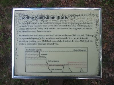
4. Eroding Sandstone Bluffs Sign
To the south and west lie hundreds of square miles of sandstone and dolomite uplands. These extensive rock layers once overlaid this area, but streams have eroded them away. Today, only isolated remnants of this large upland remain. Mill Bluff is one of these remnants.
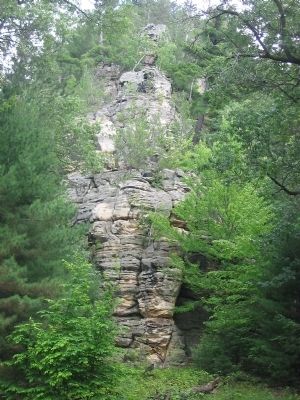
Mill Bluff owes its existence to a hard sandstone layer called cap rock. This cap rock protects layers of softer sandstone underneath. You can see this soft sandstone eroding from Mill Bluff as you hike this trail. In time, Mill Bluff will erode to the level of the plain around you.
Mill Bluff owes its existence to a hard sandstone layer called cap rock. This cap rock protects layers of softer sandstone underneath. You can see this soft sandstone eroding from Mill Bluff as you hike this trail. In time, Mill Bluff will erode to the level of the plain around you.
Credits. This page was last revised on March 7, 2021. It was originally submitted on June 10, 2010, by Keith L of Wisconsin Rapids, Wisconsin. This page has been viewed 1,378 times since then and 47 times this year. Photos: 1, 2, 3, 4, 5. submitted on June 10, 2010, by Keith L of Wisconsin Rapids, Wisconsin. • Craig Swain was the editor who published this page.
