Kenbridge in Lunenburg County, Virginia — The American South (Mid-Atlantic)
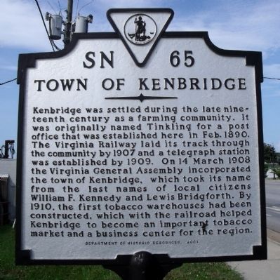
Town of Kenbridge
Erected 2001 by Department of Historic Resources. (Marker Number SN-65.)
Topics and series. This historical marker is listed in these topic lists: Political Subdivisions • Railroads & Streetcars • Settlements & Settlers. In addition, it is included in the Virginia Department of Historic Resources (DHR) series list. A significant historical date for this entry is March 14, 1908.
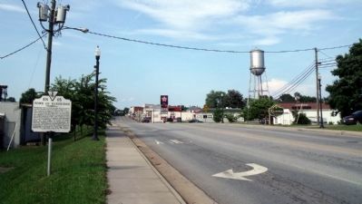
Location. 36° 57.643′ N, 78° 7.604′ W. Marker is in Kenbridge, Virginia, in Lunenburg County. Marker is at the intersection of South Broad Street (Virginia Route 40) and Main Street (Virginia Route 40), on the right when traveling south on South Broad Street. Touch for map. Marker is in this post office area: Kenbridge VA 23944, United States of America. Touch for directions.
Other nearby markers. At least 8 other markers are within 6 miles of this marker, measured as the crow flies. Craig's Mill (a few steps from this marker); St. John’s Church (approx. 0.2 miles away); Kennedy's Store ca. 1908 (approx. 0.2 miles away); The Glebe of Cumberland Parish (approx. 2.4 miles away); Lunenburg County / Nottoway County (approx. 4.7 miles away); Lunenburg High School (approx. 4.7 miles away); Nathaniel Lee Hawthorne (approx. 5˝ miles away); The Peoples Community Center (approx. 5.7 miles away). Touch for a list and map of all markers in Kenbridge.
Also see . . . Wikipedia for Kenbridge, Virginia. (Submitted on June 17, 2010, by Jeff Conner of Norfolk, Virginia.)
Credits. This page was last revised on June 16, 2016. It was originally submitted on June 14, 2010, by Bernard Fisher of Richmond, Virginia. This page has been viewed 1,270 times since then and 98 times this year. Photos: 1, 2. submitted on June 14, 2010, by Bernard Fisher of Richmond, Virginia.

