Mount Pleasant in Charleston County, South Carolina — The American South (South Atlantic)
The King's Highway / Coleman Boulevard
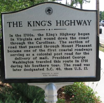
In the 1700s, the King's Highway began in Virginia and wound down the coast through the Carolinas. The section of road that passed through Mount Pleasant became one of the first coastal roadways serving as a colonial post road for the delivery of mail. President George Washington traveled this route in 1791 during his Southern tour. The road was later designated S.C. 40, then U.S. 17.
(Reverse):
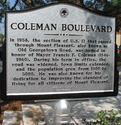
In 1958, the section of U.S. 17 that passed through Mount Pleasant, also known as Old Georgetown Road, was named in honor of Mayor Francis F. Coleman (1946-1960). During his term in office, the road was widened, town limits extended and the population grew from 1500 to 5000. He was also known for his dedication to improving the standard of living for all citizens of Mount Pleasant.
Erected 2004.
Topics. This historical marker is listed in these topic lists: Colonial Era • Roads & Vehicles. A significant historical year for this entry is 1791.
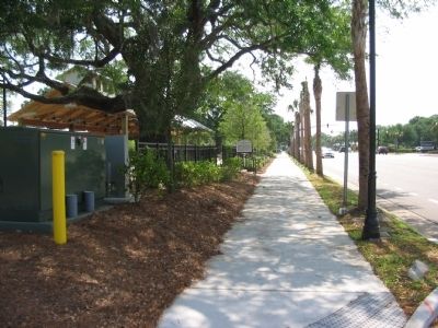
Location. 32° 47.461′ N, 79° 52.416′ W. Marker is in Mount Pleasant, South Carolina, in Charleston County. Marker is at the intersection of Coleman Avenue (U.S. 17) and Simmons Street, on the right when traveling east on Coleman Avenue. Touch for map. Marker is in this post office area: Mount Pleasant SC 29464, United States of America. Touch for directions.
Other nearby markers. At least 8 other markers are within walking distance of this marker. "The Kings Highway" (within shouting distance of this marker); General William Moultrie / Moultrie Schools (about 300 feet away, measured in a direct line); Jasper Green/ Sergeant William Jasper (about 400 feet away); Etiwan Masonic Lodge (approx. ¼ mile away); St. Andrew's Church (approx. ¼ mile away); Mount Pleasant Presbyterian Church (approx. 0.3 miles away); Laing School (approx. 0.3 miles away); Pitt Street Merchants (approx. 0.3 miles away). Touch for a list and map of all markers in Mount Pleasant.
Also see . . . The King's Highway. Wikipedia article, with a map tracing the route of the road. (Submitted on June 14, 2010, by Craig Swain of Leesburg, Virginia.)
Credits. This page was last revised on January 23, 2020. It was originally submitted on June 14, 2010, by Craig Swain of Leesburg, Virginia. This page has been viewed 771 times since then and 26 times this year. Photos: 1, 2, 3. submitted on June 14, 2010, by Craig Swain of Leesburg, Virginia.


