Cave City in Edmonson County, Kentucky — The American South (East South Central)
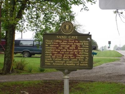
Sand Cave
Erected 1970 by The Kentucky Historical Society and the Department of Highways. (Marker Number 1385.)
Topics and series. This historical marker is listed in these topic lists: Natural Features • Notable Events. In addition, it is included in the Believe It or Not, and the Kentucky Historical Society series lists. A significant historical date for this entry is January 30, 1925.
Location. 37° 9.009′ N, 86° 2.618′ W. Marker is in Cave City, Kentucky, in Edmonson County. Marker is on Old Mammoth Cave Road (at milepost 15), 1.2 miles north of Mammoth Cave Road (Kentucky Route 70), on the right when traveling west. Touch for map. Marker is at or near this postal address: 1240 Old Mammoth Cave Rd, Cave City KY 42127, United States of America. Touch for directions.
Other nearby markers. At least 5 other markers are within 3 miles of this marker, measured as the crow flies. Union City: Cave Crossroads (approx. 1.8 miles away); Locust Grove Cemetery (approx. 1.8 miles away); Hearth and Home (approx. 1.8 miles away); Diamond Caverns (approx. 2.6 miles away); a different marker also named Diamond Caverns (approx. 2.6 miles away).
More about this marker. Marker is next to the Wayfarer Hotel, where there is a museum, and a path to the cave entrance.
Also see . . . Floyd Collins: America's Greatest Doomed Cave Explorer. A better telling, this page also continues the story past his death; telling of his glass-topped coffin, the chained coffin, and his body's brief visit to a near-by field, where he lost his leg. (Submitted on April 29, 2006.)
Credits. This page was last revised on October 21, 2020. It was originally submitted on April 29, 2006, by Trinket Troy of Burke, Virginia. This page has been viewed 4,662 times since then and 32 times this year. Photo 1. submitted on April 29, 2006, by Trinket Troy of Burke, Virginia. • J. J. Prats was the editor who published this page.
Editor’s want-list for this marker. Photo of cave entrance • Marker at cave entrance • Can you help?
