Sullivans Island in Charleston County, South Carolina — The American South (South Atlantic)
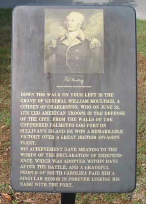
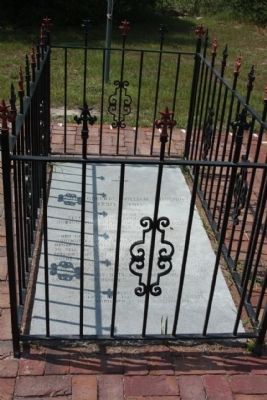
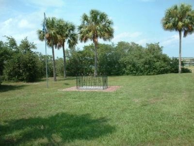
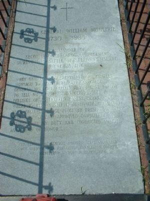
Grave of General William Moultrie
His achievement gave meaning to the words of the Declaration of Independence, which was adopted within days after the battle, and a grateful people of South Carolina paid him a singular honor in forever linking his name with the port.
Topics. This historical marker is listed in these topic lists: Patriots & Patriotism • War, US Revolutionary. A significant historical month for this entry is June 1857.
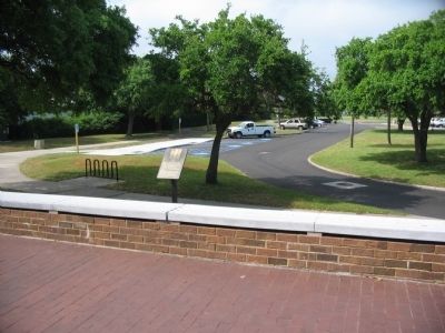
Location. 32° 45.631′ N, 79° 51.45′ W. Marker is on Sullivans Island, South Carolina, in Charleston County. Marker is on Middle Street, on the right when traveling west. Located at the entrance to the Fort Moultrie visitor center. Touch for map. Marker is in this post office area: Sullivans Island SC 29482, United States of America. Touch for directions.
Other nearby markers. At least 8 other markers are within walking distance of this marker. Historic Fort Sumter - Fort Sumter Today (a few steps from this marker); Defending Charleston (within shouting distance of this marker); Fort Moultrie Torpedo Storehouse (within shouting distance of this marker); Station Hospital (within shouting distance of this marker); a different marker also named Fort Moultrie Torpedo Storehouse (within shouting distance of this marker); Oceola / Patapsco Dead (about 300 feet away, measured in a direct line); Northwest Bastionet (about 300 feet away); From Military Base to National Park (about 300 feet away). Touch for a list and map of all markers in Sullivans Island.
Photographed By Mike Stroud, August 14, 2011
3. Grave of General William Moultrie
1730 - 1805
Second South Carolina Regiment
During the Battle of Sullivan's Island
June 28, 1776
When offered inducements by Lord Charles
Hontagu to desert the American cause,
General Moultrie replied "...You have forgot
to tell me how I am to get rid of the
feelings of an injured honest heart, and
where to hide myself from myself... this would
be a fatal exchange from my present situation
with an easy and approved conscience of
having done my duty, and conducted myself
as a man of honor."
The remains of General Moultrie were recovered
from Windsor Hill Plantation, Charleston County,
and reinterred at Fort Moultrie, 1978.
Photographed By Allen C. Browne, August 9, 2015
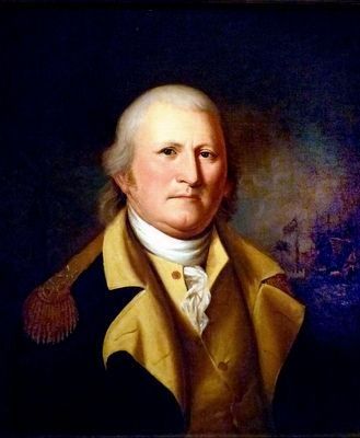
4. William Moultrie
This 1782 portrait of William Moultrie by Charles Willson Peale hangs in the National Portrait Gallery in Washington, DC.
“In June 1776, as eight British warships stood poised to put a quick end to the rebellion in the South, William Moultrie, a planter with some experience as a militia captain, was in charge of the hastily built fort on Sullivan's Island in Charles Town harbor. The soft palmetto logs of the fort successfully absorbed bombardment from one hundred guns, whereas Moultrie's men discharged their twenty-five guns with a deliberation that demolished ship rigging and slaughtered enemy sailors. After eleven and a half hours, the British slipped away, giving South Carolina a three-year respite from war.
In the background of this portrait showing Moultrie, risen to a general in the Continental army can be glimpsed the famous fort, renamed in Moultrie's honor.” — National Portrait Gallery
Credits. This page was last revised on June 14, 2022. It was originally submitted on June 15, 2010, by Craig Swain of Leesburg, Virginia. This page has been viewed 1,328 times since then and 54 times this year. Photos: 1, 2. submitted on June 15, 2010, by Craig Swain of Leesburg, Virginia. 3. submitted on August 16, 2011, by Mike Stroud of Bluffton, South Carolina. 4. submitted on August 26, 2015, by Allen C. Browne of Silver Spring, Maryland. 5, 6. submitted on August 16, 2011, by Mike Stroud of Bluffton, South Carolina.
