Blaine in Grainger County, Tennessee — The American South (East South Central)
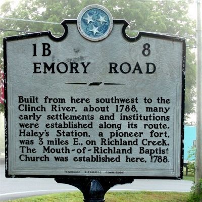
Emory Road
Erected 1940 by Tennessee Historical Commission. (Marker Number 1B 8.)
Topics and series. This historical marker is listed in these topic lists: Churches & Religion • Forts and Castles • Roads & Vehicles • Settlements & Settlers. In addition, it is included in the Tennessee Historical Commission series list. A significant historical year for this entry is 1788.
Location. 36° 9.247′ N, 83° 42.342′ W. Marker is in Blaine, Tennessee, in Grainger County. Marker is at the intersection of Emory Road (Tennessee Route 331) and Blaine Drive, on the left when traveling west on Emory Road. Touch for map. Marker is in this post office area: Blaine TN 37709, United States of America. Touch for directions.
Other nearby markers. At least 8 other markers are within 9 miles of this marker, measured as the crow flies. Blaine's Crossroads (approx. 0.3 miles away); Janeway Cabin (approx. 0.3 miles away); Shields Station (approx. 0.9 miles away); Richland: Birthplace of Albert Miller Lea (approx. 1.7 miles away); Sawyer's Fort (approx. 2.7 miles away); George Mann (approx. 7.8 miles away); Nicholas Gibbs Homestead (approx. 8 miles away); Horace Maynard (approx. 8.4 miles away). Touch for a list and map of all markers in Blaine.
More about this marker. This marker was moved in 2004 during construction which blocked the original entrance to Emory Road from Rutledge Pike. The current location is 300 yards from the original location at the intersection of Emory Road and Rutledge Pike (US 11W). It was moved by Tennessee Dept of Transportation.
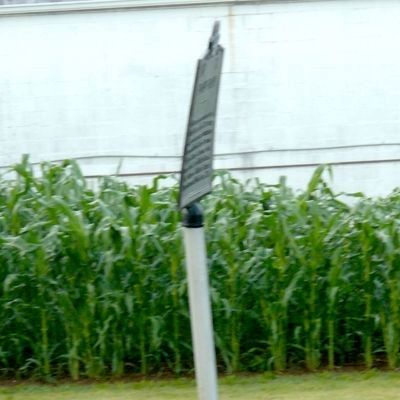
It is now damaged and loosely attached to the post. The cast aluminum is bent in a curve and the allen screws attaching to the post are badly rusted and not screwed in securely. It needs attention before it falls.
Regarding Emory Road. This road was commissioned by the Continental Congress in 1780s as part of the development of Post roads to connect communication between the central government and Nashville TN and New Orleans. Most of Emory Road is in Knox County and it continues into Anderson County and Oak Ridge. Another Marker is in the city of Oak Ridge which will be posted later.
Additional keywords. Post Road Continental Congress
Credits. This page was last revised on September 18, 2020. It was originally submitted on June 20, 2010, by Donald Raby of Knoxville, Tennessee. This page has been viewed 2,973 times since then and 84 times this year. Photos: 1, 2, 3. submitted on June 20, 2010, by Donald Raby of Knoxville, Tennessee. • Kevin W. was the editor who published this page.


