Mount Vernon near Alexandria in Fairfax County, Virginia — The American South (Mid-Atlantic)
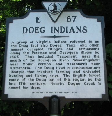
Doeg Indians
Erected 2003 by Department of Historic Resources. (Marker Number E-67.)
Topics and series. This historical marker is listed in these topic lists: Native Americans • Settlements & Settlers. In addition, it is included in the Virginia Department of Historic Resources (DHR) series list. A significant historical year for this entry is 1607.
Location. 38° 42.787′ N, 77° 7.837′ W. Marker is near Alexandria, Virginia, in Fairfax County. It is in Mount Vernon. Marker is on Mount Vernon Memorial Highway (State Highway 235), on the right when traveling south. Located across the road from the George Washington Gristmill and Distillery Historic Site. Touch for map. Marker is at or near this postal address: 5515 Mount Vernon Memorial Hwy, Alexandria VA 22309, United States of America. Touch for directions.
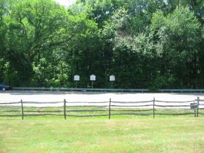
Other nearby markers. At least 8 other markers are within walking distance of this marker. George Washington's Gristmill (here, next to this marker); Woodlawn (here, next to this marker); Woodlawn Cultural Landscape Historic District (a few steps from this marker); George Washington's Distillery and Gristmill in 1799 (within shouting distance of this marker); Welcome to George Washington's Distillery & Gristmill at Mount Vernon (within shouting distance of this marker); George Washington's Whiskey Distillery Cornerstone (about 300 feet away, measured in a direct line); Woodlawn Historic Landscapes (approx. 0.3 miles away); Potomac Connections (approx. 0.3 miles away). Touch for a list and map of all markers in Alexandria.
Credits. This page was last revised on January 27, 2023. It was originally submitted on June 20, 2010, by Craig Swain of Leesburg, Virginia. This page has been viewed 1,773 times since then and 158 times this year. Photos: 1, 2. submitted on June 20, 2010, by Craig Swain of Leesburg, Virginia.

