Mission Dolores in San Francisco City and County, California — The American West (Pacific Coastal)
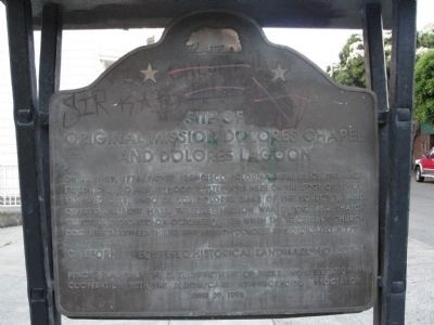
Site of Original Mission Dolores Chapel and Dolores Lagoon / Rammaytush
Inscription.
On June 29, 1776, Father Francisco Palou, a member of the Anza Expedition, had a brushwood shelter here on the edge of a now vanished lake, Lago de los Dolores (Lake of the Sorrows), and offered the first mass. The first mission was a log and thatch structure dedicated on October 9, 1776 when the necessary church documents arrived. The present Mission Dolores was dedicated in 1791.
California Registered Historical Landmark No. 327-1
Plaque placed by the state Department of Parks and Recreation in cooperation with the Albion/Camp Neighborhood Association - June 29, 1995
Reverse:
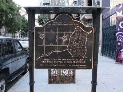
Dedicated to the Rammaytush, the First People of San Francisco.
*Sun, moon, sky, village, friend, alive: we eat, drink sing and dance.
--Rammaytush.
[Map of San Francisco, highlighting Dolores Lagoon, Arroyo de los Dolores, and the sites of the 1776 and 1791 Mission Churches.]
Erected 1995 by California Dept. of Parks & Recreation and the Albion/Camp Neighborhood Assoc. (Marker Number 327-1.)
Topics and series. This historical marker is listed in these topic lists: Churches & Religion • Exploration • Hispanic Americans • Native Americans. In addition, it is included in the California Historical Landmarks series list. A significant historical date for this entry is June 29, 1776.
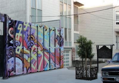
Location. 37° 45.842′ N, 122° 25.363′ W. Marker is in San Francisco, California, in San Francisco City and County. It is in Mission Dolores. Marker is at the intersection of Albion Street and Camp Street on Albion Street. Marker is on Albion Street at the end of Camp Street and midway between 16th and 17th Streets. Touch for map. Marker is in this post office area: San Francisco CA 94110, United States of America. Touch for directions.
Other nearby markers. At least 8 other markers are within walking distance of this marker. The Coast Miwok (about 400 feet away, measured in a direct line); Elixir (about 600 feet away); The Frank J. Portman Memorial Diorama (approx. 0.2 miles away); El Camino Real (approx. 0.2 miles away); Misión San Francisco de Asís (approx. 0.2 miles away); Fray Francisco Palou, O.F.M. (approx. ¼ mile away); La Misión San Francisco de Asís (approx. ¼ mile away); Guillermo Granizo (approx. ¼ mile away). Touch for a list and map of all markers in San Francisco.
Also see . . .
1. "Ramaytush". (Submitted on June 21, 2010, by Richard E. Miller of Oxon Hill, Maryland.)
2. The Ohlone People. (Submitted on June 21, 2010, by Richard E. Miller of Oxon Hill, Maryland.)
3. NPR: "New Water Map Washes Away An Urban Legend". (Submitted on November 7, 2011, by Richard E. Miller of Oxon Hill, Maryland.)
Additional keywords. "Ramaytush"; Ohlone; La Misión de Nuestro Padre San Francisco de Asís.
Credits. This page was last revised on January 28, 2024. It was originally submitted on June 20, 2010, by Richard E. Miller of Oxon Hill, Maryland. This page has been viewed 1,617 times since then and 47 times this year. Photos: 1. submitted on June 20, 2010, by Richard E. Miller of Oxon Hill, Maryland. 2, 3. submitted on June 21, 2010, by Richard E. Miller of Oxon Hill, Maryland. • Syd Whittle was the editor who published this page.


