Delafield in Waukesha County, Wisconsin — The American Midwest (Great Lakes)
Lapham Peak
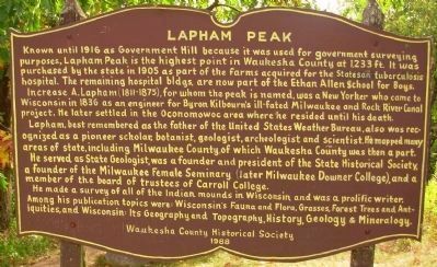
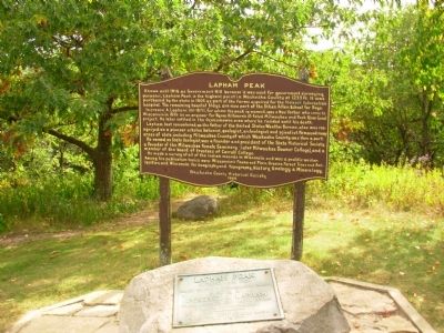
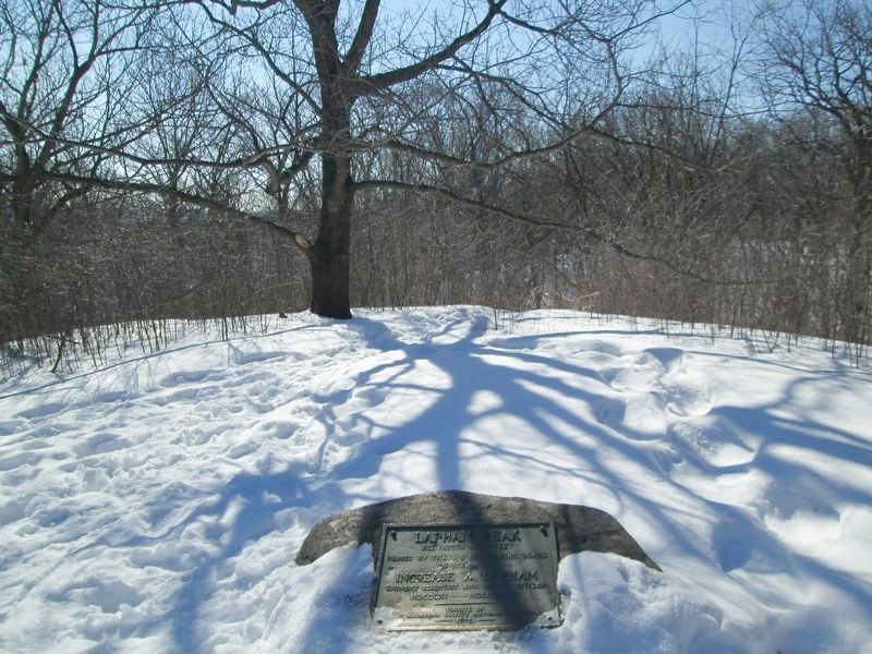
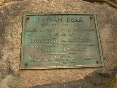
Known until 1916 as Government Hill because it was used for government surveying purposes, Lapham Peak is the highest point in Waukesha County at 1233 ft. It was purchased by the state in 1905 as part of the farms acquired for the Statesan tuberculosis hospital. The remaining hospital bldgs. are now part of the Ethan Allen School for Boys.
Increase A. Lapham (1811-1875), for whom the peak is named, was a New Yorker who came to Wisconsin in 1836 as an engineer for Byron Kilbourn’s ill-fated Milwaukee and Rock River Canal project. He later settled in the Oconomowoc area where he resided until his death.
Lapham, best remembered as the father of the United States Weather Bureau, also was recognized as a pioneer scholar, botanist, geologist, archeologist and scientist. He mapped many areas of state, including Milwaukee County, of which Waukesha County was then a part.
He served as State Geologist, was a founder and president of the State Historical Society, a founder of the Milwaukee Female Seminary (later Milwaukee Downer College), and a member of the board of trustees of Carroll College.
He made a survey of all Indian mounds in Wisconsin and was a prolific writer. Among his publication topics were: Wisconsin’s Fauna and Flora, Grasses, Forest tress and Antiquities, and Wisconsin: Its Geography and Topography, History, Geology & Mineralogy.
Erected 1988 by Waukesha County Historical Society. (Marker Number 05-03.)
Topics. This historical marker is listed in these topic lists: Anthropology & Archaeology • Communications • Education • Native Americans • Science & Medicine. A significant historical year for this entry is 1916.
Location. 43° 1.947′ N, 88° 23.558′ W. Marker is in Delafield, Wisconsin, in Waukesha County. Marker can be reached from County Road C, one mile south of Interstate 94, on the right when traveling north. Marker is located in the Lapham Peak Unit of the Kettle Morraine State Forest. Touch for map. Marker is in this post office area: Delafield WI 53018, United States of America. Touch for directions.
Other nearby markers. At least 8 other markers are within 3 miles of this marker, measured as the crow flies. A different marker also named Lapham Peak (within shouting distance of this marker); Hawks Inn (approx. 2 miles away); Delafield Fish Hatchery (approx. 2.1 miles away); Cushing Memorial Park (approx. 2.3 miles away); St. John's Military Academy (approx. 2.3 miles away); Northwestern Military and Naval Academy (approx. 2.3 miles away); Waterville (approx. 2˝ miles away); Capel Log (approx. 2.6 miles away). Touch for a list and map of all markers in Delafield.
Related markers. Click here for a list of markers that are related to this marker. To better understand the relationship, study each marker in the order shown.
Additional commentary.
1. Increase Lapham Claim to Fame
Increase Lapham's claim to fame was his work with meteorology and helping the Smithsonian Institution with weather observation in the Great Lakes region. He proposed a national weather service to Congress, and it was adopted on Feb. 9, 1870. At that time, a national weather station was set up here to receive data from Pikes Peak, Colorado, which was then relayed to the Weather Bureau in Chicago.
— Submitted June 4, 2011, by Linda Hansen of Waukesha, Wisconsin.
Credits. This page was last revised on April 12, 2023. It was originally submitted on June 21, 2010, by Paul Fehrenbach of Germantown, Wisconsin. This page has been viewed 1,895 times since then and 32 times this year. Last updated on April 12, 2023, by Linda Hansen of Waukesha, Wisconsin. Photos: 1, 2. submitted on June 21, 2010, by Paul Fehrenbach of Germantown, Wisconsin. 3. submitted on February 26, 2021, by Jim Schaettle of Madison, Wisconsin. 4. submitted on June 21, 2010, by Paul Fehrenbach of Germantown, Wisconsin. • Devry Becker Jones was the editor who published this page.


