Jim Thorpe in Carbon County, Pennsylvania — The American Northeast (Mid-Atlantic)
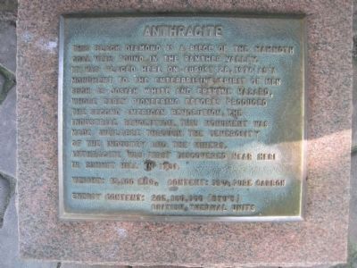
Anthracite
Anthracite was first discovered near here in Summit Hill in 1791.
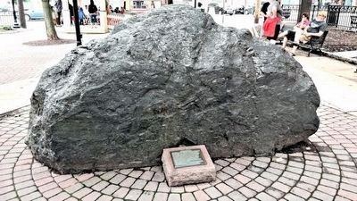
Weight: 15,100 lbs. Content: 99% pure carbon
Energy content: 205,360,000 (BTU's)
Topics. This historical marker is listed in these topic lists: Industry & Commerce • Natural Resources. A significant historical year for this entry is 1976.
Location. 40° 51.789′ N, 75° 44.277′ W. Marker is in Jim Thorpe, Pennsylvania, in Carbon County. Marker is at the intersection of East Catawissa Street (U.S. 209) and Susquehanna Street (U.S. 209) on East Catawissa Street. Touch for map. Marker is in this post office area: Jim Thorpe PA 18229, United States of America. Touch for directions.
Other nearby markers. At least 8 other markers are within walking distance of this marker. From Mountain to Market (here, next to this marker); Mauch Chunk Railroad Station (a few steps from this marker); Packer Mansion (a few steps from this marker); Carbon County (within shouting distance of this marker); The Self Made Man (about 300 feet away, measured in a direct line); The Soldiers and Sailors Monument (about 300 feet away); Joe Boyle Plaza (about 300 feet away); The Mansion House (about 500 feet away). Touch for a list and map of all markers in Jim Thorpe.
Credits. This page was last revised on October 14, 2019. It was originally submitted on June 25, 2010, by Kevin W. of Stafford, Virginia. This page has been viewed 894 times since then and 47 times this year. Last updated on October 12, 2019, by Laura Klotz of Northampton, Pennsylvania. Photos: 1. submitted on June 25, 2010, by Kevin W. of Stafford, Virginia. 2. submitted on August 15, 2015, by Carolyn Martienssen of West Hazleton, Pennsylvania. 3. submitted on June 25, 2010, by Kevin W. of Stafford, Virginia. • Bill Pfingsten was the editor who published this page.


