Niantic in East Lyme in New London County, Connecticut — The American Northeast (New England)
Bride Brook
A.D. 1646 – 1647
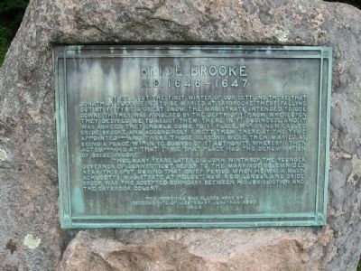
"It fell out the first winter of our settling there that Jonathan Rudd being to be maried at Saybrooke there falling out at yt tyme a great snow the magistrate intended to goe downe thither was hindered by the depth of yt snow where upon they desired me to assist them there in yt businesse and it was agreed they should come to yt place wch is now called Bride Brooke and accordingly I mett them there at the tyme appointed *** and there those persons were then maried as being a place wth in ye bounds of yt authority whereby I then acted *** and at that tyme that place had the denomination of Bride Brooke."
Thus, many years later did John Winthrop the Younger, Governor of Connecticut refer to the marriage solemnized near this spot, during that brief period when he was a Massachusetts magistrate at Pequot, now New London, and Bride Brook was the accepted boundary between his jurisdiction and the Saybrook Colony.
Erected 1925 by Descendants of Lieutenant Jonathan Rudd.
Topics. This historical marker is listed in these topic lists: Colonial Era • Settlements & Settlers. A significant historical year for this entry is 1646.
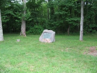
Location. 41° 19.023′ N, 72° 14.585′ W. Marker is in East Lyme, Connecticut, in New London County. It is in Niantic. Marker is at the intersection of West Main Street (Connecticut Route 156) and Liberty Way, on the right when traveling west on West Main Street. Touch for map. Marker is at or near this postal address: 255 W Main St, Niantic CT 06357, United States of America. Touch for directions.
Other nearby markers. At least 8 other markers are within 3 miles of this marker, measured as the crow flies. The Hole in the Wall (approx. 2˝ miles away); McCook Point (approx. 2.6 miles away); A Place for Play (approx. 2.6 miles away); East Lyme (approx. 2.6 miles away); The Iron Horse (approx. 2.7 miles away); East Lyme Veterans Memorial (approx. 2.7 miles away); East Lyme Honor Roll (approx. 2.7 miles away); A Glimpse into the Past (approx. 2.7 miles away). Touch for a list and map of all markers in East Lyme.
Credits. This page was last revised on June 29, 2023. It was originally submitted on June 27, 2010, by Michael Herrick of Southbury, Connecticut. This page has been viewed 1,391 times since then and 53 times this year. Last updated on June 7, 2023, by Global Bing of Dedham, Massachusetts. Photos: 1, 2. submitted on June 27, 2010, by Michael Herrick of Southbury, Connecticut.

