Near De Soto in Vernon County, Wisconsin — The American Midwest (Great Lakes)
Head of Battle Isle
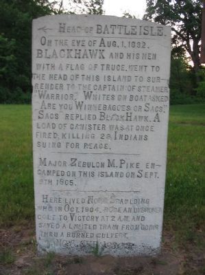
← Head of Battle Isle.
_____________________
On the eve of Aug. 1, 1832,
Black Hawk and his men
with a flag of truce, went to
the head of this island to sur-
render to the captain of steamer
"Warrior." Whites on boat asked
Are you Winnebagoes or Sacs."
Sacs replied Black Hawk. A
load of canister was at once
fired, killing 28 Indians
suing for peace.
_____________________
Major Zebulon M. Pike en-
camped this island on Sept.
9th 1805.
_____________________
Here lived Norm Spaulding
who in Oct. 1904, rode an unbroken
colt to Victory at 2 a.m. and
saved a limited train from going
thru a burned culvert.
No. 6 CVP 1930 S
Erected 1930 by Viroqua, Wisconsin historian Dr. C.V. Porter. (Marker Number 6 CVP.)
Topics and series. This historical marker is listed in these topic lists: Animals • Native Americans • Wars, US Indian. In addition, it is included in the Black Hawk War series list. A significant historical month for this entry is August 1825.
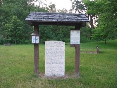
Location. 43° 27.31′ N, 91° 13.59′ W. Marker is near De Soto, Wisconsin, in Vernon County. Marker can be reached from County Road BI, 1.9 miles west of Great River Road (State Highway 35). Marker is on a Mississippi River island south of the West Loop Camp Area in Blackhawk Park. Touch for map. Marker is at or near this postal address: E590 County Highway BI, De Soto WI 54624, United States of America. Touch for directions.
Other nearby markers. At least 8 other markers are within 8 miles of this marker, measured as the crow flies. Battle of Bad Axe (approx. 0.7 miles away); Black Hawk War (approx. 0.7 miles away); Chief Win-no-shik, the Elder (approx. 2.2 miles away); Winneshiek’s Landing (approx. 2.2 miles away); Black Hawks Outpost (approx. 3 miles away); Site of Red Bird's Village (approx. 4.1 miles away); Black Hawk and Winnebago Trail (approx. 6.6 miles away); La Crosse Boiling Water Reactor (approx. 7.7 miles away). Touch for a list and map of all markers in De Soto.
Also see . . . Zebulon Pike. Wikipedia entry. "Pike's account of his southwest expedition was published in 1810 as The expeditions of Zebulon Montgomery Pike to headwaters of the Mississippi River, through Louisiana Territory, and in New Spain, during the years 1805-6-7..." (Submitted on June 27, 2010.)

Photographed By Keith L, June 6, 2010
3. Historic Trail Markers Sign
[map]
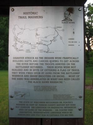
Disaster struck as the Indians were frantically building rafts and canoes hoping to get across the river before the troops arrived or the battleship returned. Their hopes were not realized and in spite of offering a flag of truce, they were fired upon by guns from the battleship Warrior and sharp shooters on shore. Most of the band was annihilated in what has been called "The Black Hawk Massacre".
Grateful appreciation is given to Dr. C.V. Porter whose hard work and dedication preserved this segment of history for all.
Vernon County Historical Society
Wisconsin Humanities Committee
Wisconsin State Dept. of Transportation
Vernon County Highway Department
U.S. Army Corps of Engineers-Black Hawk Park
The State of Wisconsin recognizes Dr. Porter's markers as part of Vernon County history but does not condone the language or prejudicial inferences used on some of the markers. Dr. Porter used descriptive, interpretative language which he researched and felt was acceptable for his time.
Credits. This page was last revised on December 30, 2019. It was originally submitted on June 27, 2010, by Keith L of Wisconsin Rapids, Wisconsin. This page has been viewed 1,961 times since then and 99 times this year. Photos: 1, 2, 3. submitted on June 27, 2010, by Keith L of Wisconsin Rapids, Wisconsin.

