Edisto in Orangeburg County, South Carolina — The American South (South Atlantic)
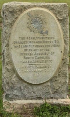
Orangeburgh and Ninety Six Road
Orangeburgh and Ninety Six,
was laid out under provision
of an act of the
General Assembly of
South Carolina
Passed April 7, 1770
———
Marker placed by
Eutaw Chapter, D.A.R.
1917.
Erected 1917 by Eutaw Chapter, D.A.R.
Topics and series. This historical marker is listed in these topic lists: Colonial Era • Roads & Vehicles. In addition, it is included in the Daughters of the American Revolution series list. A significant historical date for this entry is April 7, 1770.
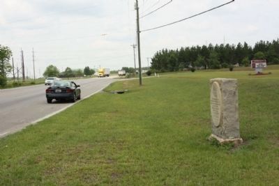
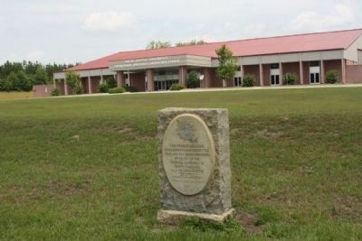
Location. 33° 28.852′ N, 80° 54.611′ W. Marker is in Edisto, South Carolina, in Orangeburg County. Marker is on Neeses Highway (State Highway 4) half a mile west of Old Edisto Road (U.S. 301), on the right when traveling west. Located in front of the Seventh-Day Adventist Convention Center. Touch for map. Marker is at or near this postal address: 524 Neeses Hwy, Orangeburg SC 29115, United States of America. Touch for directions.
Other nearby markers. At least 8 other markers are within 3 miles of this marker, measured as the crow flies. Zion Church (approx. 1.9 miles away); Defense of Edisto Bridge (approx. 2.1 miles away); Albergotti Playground (approx. 2.1 miles away); Confederate Flag (approx. 2.2 miles away); Orangeburg County / Discovering Orangeburg (approx. 2.2 miles away); Veterans Memorial Fountain (approx. 2.3 miles away); Veterans Memorial Park (approx. 2.3 miles away); Pioneer Graveyard (approx. 2.6 miles away).
Credits. This page was last revised on May 2, 2023. It was originally submitted on June 28, 2010, by Mike Stroud of Bluffton, South Carolina. This page has been viewed 856 times since then and 48 times this year. Last updated on April 30, 2023, by Carolyn Sanders of Plano, Texas. Photos: 1, 2, 3. submitted on June 28, 2010, by Mike Stroud of Bluffton, South Carolina. • Bernard Fisher was the editor who published this page.


