Odem in San Patricio County, Texas — The American South (West South Central)
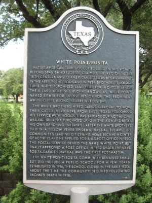
White Point / Rosita
The White brothers hired Darius C. Rachal to move their cattle herd here from East Texas. Following his service with Hood's Texas Brigade during the Civil War. Rachal also purchased land in the area and began his own ranching enterprise. After the White brothers died in a yellow fever epidemic, Rachal became the community's leading citizen. His home became a center of activity, and he applied for a U.S. post office in 1890. The Postal Service denied the name White Point, but finally approved a post office in 1892 under the Rosita, Darius C. Rachal was the first postmaster.
The White Point / Rosita community remained small, but did include a public school for a few years. Established in 1916, the school closed in the early 1920s, about the time the community declined following Rachal's death in 1918.
Erected 1994 by Texas Historical Commission. (Marker Number 14784.)
Topics. This historical marker is listed in this topic list: Settlements & Settlers. A significant historical year for this entry is 1856.
Location. 27° 56.995′ N, 97° 34.988′ W. Marker is in Odem, Texas, in San Patricio County. Marker is at the intersection of Voss Avenue (U.S. 77) and West Humphries Street, on the right when traveling south on Voss Avenue. Touch for map. Marker is in this post office area: Odem TX 78370, United States of America. Touch for directions.
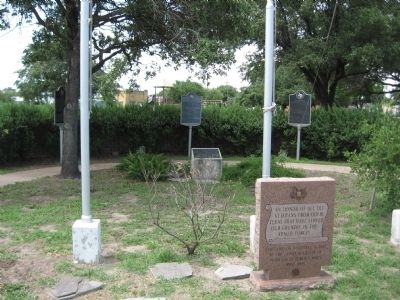
Other nearby markers. At least 8 other markers are within 7 miles of this marker, measured as the crow flies. Early Odem Area Schools (here, next to this marker); Odem Veterans Memorial (here, next to this marker); Meansville and Kaleta (within shouting distance of this marker); Odem First Baptist Church (approx. 0.3 miles away); First United Methodist Church of Odem (approx. 0.6 miles away); Bethel Baptist Church of Christ and Cemetery (approx. 1.4 miles away); Nuecestown (approx. 6˝ miles away); Nuecestown Raid (approx. 6˝ miles away). Touch for a list and map of all markers in Odem.
Credits. This page was last revised on June 16, 2016. It was originally submitted on June 28, 2010, by Steve Gustafson of Lufkin, Texas. This page has been viewed 1,006 times since then and 40 times this year. Photos: 1, 2. submitted on June 28, 2010, by Steve Gustafson of Lufkin, Texas. • Kevin W. was the editor who published this page.

