Schenectady in Schenectady County, New York — The American Northeast (Mid-Atlantic)
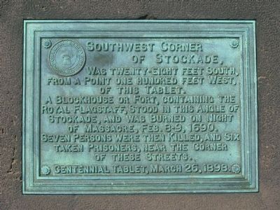
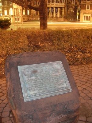
Southwest Corner of Stockade
Erected 1898.
Topics. This historical marker is listed in these topic lists: Colonial Era • Forts and Castles. A significant historical date for this entry is March 16, 1888.
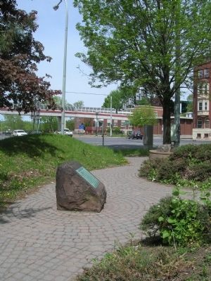
Location. 42° 48.894′ N, 73° 56.916′ W. Marker is in Schenectady, New York, in Schenectady County. Marker can be reached from State Street, in the median. The marker can not be seen from the street as it is situated in the midst of Schenectady's Liberty Park. Liberty Park is small triangular area of 0.20 (two tenths of an acre) bounded on two sides by State Street and Washington Ave. on the third in down town Schenectady, across the street from the Schenectady County Community College. Touch for map. Marker is in this post office area: Schenectady NY 12305, United States of America. Touch for directions.
Other nearby markers. At least 8 other markers are within walking distance of this marker. M-7 Day (here, next to this marker); First Site of Old Dutch Church (a few steps from this marker); Freemasonry (within shouting distance of this marker); South Shore Road (within shouting distance of this marker); Clench's Tavern (within shouting distance of this marker); Hotel Van Curler (about 300 feet away, measured in a direct line); Schenectady (about 300 feet away); ca 1850 (about 300 feet away). Touch for a list and map of all markers in Schenectady.

Photographed By Howard C. Ohlhous, November 30, 2019
5. Gateway Plaza, New Location of Southwest Corner of Stockade Marker
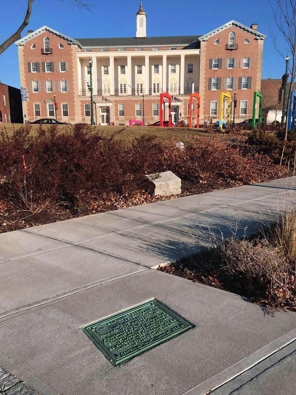
The Route 5 Transit Gateway Linkage Study had determined prior to November of 2012 that Schenectady's Liberty Park was overgrown, neglected, and suffered from security issues due to the berms in the park, as well as a design which was difficult to maintain. Liberty Park was subsequently redesigned and expanded into Gateway Plaza. During implementation of this plan the seven historic markers in the park were removed, and later, five of the seven were reinstalled. Here is the Southwest Corner of Stockade marker, embedded in the concrete of the pedestrian walkway, with the familiar former-YMCA building in the background.
Credits. This page was last revised on December 5, 2019. It was originally submitted on June 29, 2010, by Howard C. Ohlhous of Duanesburg, New York. This page has been viewed 979 times since then and 35 times this year. Photos: 1, 2, 3, 4. submitted on June 29, 2010, by Howard C. Ohlhous of Duanesburg, New York. 5. submitted on December 2, 2019, by Howard C. Ohlhous of Duanesburg, New York. • Bill Pfingsten was the editor who published this page.


