Glen Rock in Bergen County, New Jersey — The American Northeast (Mid-Atlantic)
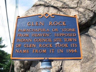
Glen Rock
Pamachapura, or "Stone
From Heaven", supposed
Indian council site. Town
of Glen Rock took its
name from it in 1894.
Topics. This historical marker is listed in these topic lists: Native Americans • Settlements & Settlers. A significant historical year for this entry is 1894.
Location. 40° 57.766′ N, 74° 8.086′ W. Marker is in Glen Rock, New Jersey, in Bergen County. Marker is at the intersection of Rock Road and Doremus Avenue, on the left when traveling west on Rock Road. Located next to the "Glen Rock". Touch for map. Marker is in this post office area: Glen Rock NJ 07452, United States of America. Touch for directions.
Other nearby markers. At least 8 other markers are within 2 miles of this marker, measured as the crow flies. Glen Rock Honor Roll (here, next to this marker); This Bell (about 500 feet away, measured in a direct line); Glen Rock Honored Heroes (approx. 0.3 miles away); The Red Brick Schoolhouse (approx. 0.9 miles away); Hopper Family Burying Ground (approx. 1.1 miles away); Hopper House (approx. 1.1 miles away); Hopper Homestead (approx. 1.2 miles away); Hawthorne World War II Monument (approx. 1.2 miles away). Touch for a list and map of all markers in Glen Rock.
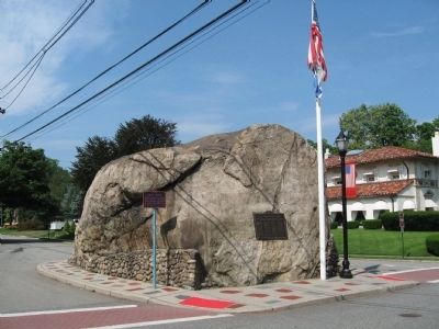
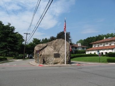
Regarding Glen Rock. Unlike most suburban towns whose names have little or nothing to do with reality, Glen Rock was actually settled around an enormous rock left by retreating glaciers in a small valley (glen). From a 1985 The New York Times article, "Glen Rock is named for a 570-ton boulder, believed to have been deposited by a glacier, that stands at the northern end of Rock Road, the town's main street. Called Pamachapura, or Stone from Heaven, by the Delaware (Lenape) Indians, it served as a base for Indian signal fires and later as a trail marker for colonists." Notwithstanding this article, Rock Road runs almost due East/West, so there is no "northern end"—nor is the rock at the end of Rock Road, which runs nearly another half mile to its western end. Also, while the Rock lies at the intersection of Rock Road and Doremus Avenue, the Rock is actually on Doremus, not Rock.
Also see . . . Glen Rock, New Jersey on Wikipedia. (Submitted on June 29, 2010, by Michael Herrick of Southbury, Connecticut.)
Credits. This page was last revised on June 16, 2016. It was originally submitted on June 29, 2010, by Michael Herrick of Southbury, Connecticut. This page has been viewed 2,049 times since then and 41 times this year. Photos: 1, 2, 3. submitted on June 29, 2010, by Michael Herrick of Southbury, Connecticut.


