Main Post in Fort Riley in Geary County, Kansas — The American Midwest (Upper Plains)
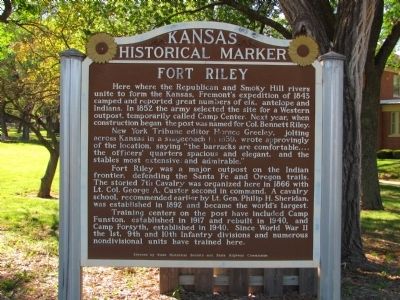
Fort Riley
Here where the Republican and Smoky Hill rivers unite to form the Kansas, Fremont's expedition of 1843 camped and reported great numbers of elk, antelope and Indians. In 1852 the army selected the site for a Western outpost, temporarily called Camp Center. Next year, when construction began the post was named for Col. Bennett Riley.
New York Tribune editor Horace Greeley, jolting across Kansas in a stagecoach in 1859, wrote approvingly of the location, saying "the barracks are comfortable,...the officers' quarters spacious and elegant, and the stables most extensive and admirable."
Fort Riley was a major outpost on the Indian frontier, defending the Santa Fe and Oregon trails. The storied 7th Cavalry was organized here in 1866 with Lt. Col. George A. Custer second in command. A cavalry school, recommended earlier by Lt. Gen. Philip H. Sheridan, was established in 1892 and became the world's largest.
Training centers on the post have included Camp Funston, established in 1917 and rebuilt in 1940, and Camp Forsyth, established in 1940. Since World War II the 1st, 9th and 10th Infantry divisions and numerous nondivisional units have trained here.
Erected by State Historical Society and State Highway Commission. (Marker Number 27.)
Topics and series. This historical marker is listed in these topic lists: Forts and Castles • Settlements & Settlers • Wars, US Indian. In addition, it is included in the Kansas Historical Society series list. A significant historical year for this entry is 1843.
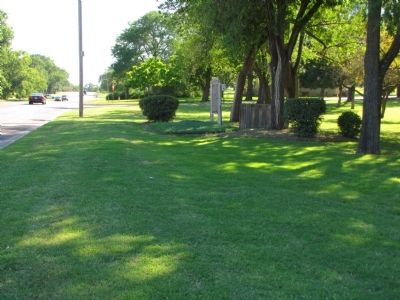
Location. 39° 4.419′ N, 96° 46.704′ W. Marker is in Fort Riley, Kansas, in Geary County. It is in Main Post. Marker is at the intersection of Huebner Road and Seitz Road, on the right when traveling west on Huebner Road. Touch for map. Marker is in this post office area: Fort Riley KS 66442, United States of America. Touch for directions.
Other nearby markers. At least 8 other markers are within walking distance of this marker. Locomotive "6072" (approx. 0.4 miles away); Tuttle Park (approx. half a mile away); Sturgis Stadium (approx. half a mile away); To the Memory of the Gallant Dead 26th Cavalry (approx. 0.7 miles away); Global War on Terrorism Monument (approx. ¾ mile away); Wounded Knee and Drexel Mission (approx. ¾ mile away); Mose Waters' General Store (approx. ¾ mile away); 9th Armored Division (approx. ¾ mile away). Touch for a list and map of all markers in Fort Riley.
Also see . . . Fort Riley, Kansas - History & Hauntings. The site of Fort Riley was chosen by surveyors in the fall of 1852 and was first called Camp Center, due to its proximity to the geographical center of the United States. (Submitted on July 13, 2010.)
Credits. This page was last revised on February 10, 2023. It was originally submitted on July 7, 2010, by Lee Hattabaugh of Capshaw, Alabama. This page has been viewed 1,222 times since then and 25 times this year. Photos: 1, 2. submitted on July 7, 2010, by Lee Hattabaugh of Capshaw, Alabama. • Syd Whittle was the editor who published this page.

