Attica in Fountain County, Indiana — The American Midwest (Great Lakes)
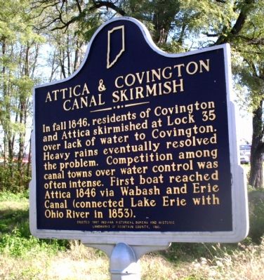
Attica & Covington Canal Skirmish
Inscription.
In fall 1846, residents of Covington and Attica skirmished at Lock 35 over lack of water to Covington. Heavy rains eventually resolved the problem. Competition among canal towns over water control was often intense. First boat reached Attica 1846 via Wabash and Erie Canal (connected Lake Erie with Ohio River in 1853).
Erected 1997 by Indiana Historical Bureau and Historic Landmarks of Fountain County, Ind. (Marker Number 23.1997.1.)
Topics and series. This historical marker is listed in these topic lists: Industry & Commerce • Settlements & Settlers • Waterways & Vessels. In addition, it is included in the Indiana Historical Bureau Markers, and the Wabash & Erie Canal series lists. A significant historical year for this entry is 1846.
Location. This marker has been replaced by another marker nearby. It was located near 40° 17.531′ N, 87° 15.12′ W. Marker was in Attica, Indiana, in Fountain County. Marker was on West Washington Street, on the right when traveling west. Located about one block from entrance of Ouibache Park, at Wabash River front. Touch for map. Marker was at or near this postal address: 200 W Washington St, Attica IN 47918, United States of America. Touch for directions.
Other nearby markers. At least 8 other markers are within walking distance of this location. Attica’s Carnegie Library (about 600 feet away, measured in a direct line); Italianate Style House (about 600 feet away); The Spirit of the American Doughboy (about 700 feet away); In Memory of (about 700 feet away); Dr. John Evans (about 700 feet away); Devon Theater (approx. 0.2 miles away); The Old Library (approx. ¼ mile away); Hotel Attica (approx. 0.3 miles away). Touch for a list and map of all markers in Attica.
More about this marker. Marker has been replaced with the "1846 Canal Skirmish" marker # 23.2023.1. See "Want List".
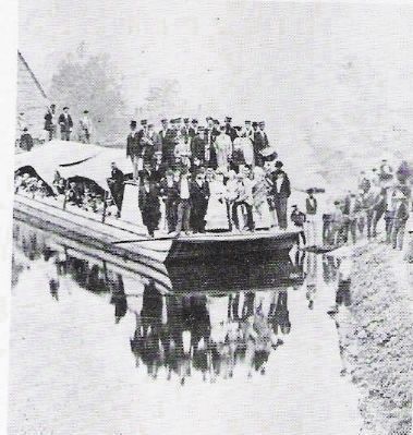
Regarding Attica & Covington Canal Skirmish. Sixteen years after Indiana became a State the Wabash & Erie Canal broke ground on Feb. 22, 1832 at Ft. Wayne, Ind. (population 300). It reached Fountain County by 1846 and was completed (at Evansville, IN) by 1853. The full route of the Wabash and Erie Canal measured 468 miles long, making it the longest artificial water way in the United States, and second longest in the world, surpassed only by “The Grand Canal” in China.
The “big drought” of the summer of 1846 brought on the “Attica-Covington War.” When water was diverted from the Wabash River, there was barely enough to fill the canal as far as Attica—and not enough for the Covington section.

Photographed By Al Wolf, November 3, 2007
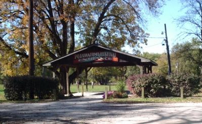
2. Ouibache Park Entrance
In view of this historical marker is the Ouibache Park Entrance which is the center of the annual "Potawatomi Festival". The Potawatomi Indians lived and passed through this area of the Wabash River for many years. The Fountain County area celebrates its rich Potawatomi Indian heritage here in Attica.
United States Senator Edward A Hannegan happened to be home in Covington (from Washington, D.C.). He attempted to convince the Attica citizens to open the flood gates, but they refused. By daylight, the Honorable Senator and 300 Covington townspeople with clubs stormed up “River Road.” Attica residents responded too late with too few, and the flood gates were forced open. There was not enough water! In a matter of minutes 30 canal boats laid on their side, mired in mud.
Reason finally prevailed as all now saw the need to wait for fall rains. For the next few years, both towns flourished from the traffic between Lake Erie and the Mouth of the Mississippi via the Ohio River. In the end, the canal was too expensive to maintain, and when less costly railroads were completed nearby, its use declined dramatically. By 1860, portions south of Terre Haute were closed and the process of decline continued northward. In 1876, the entire canal in Indiana was sold at auction.
Also see . . .
1. "The men who dug the Canal". A light and lively song with many old photos of canal builders in the process of digging a canal. (Submitted on July 8, 2009, by Al Wolf of Veedersburg, Indiana.)
2. "Angel of the Canal" ::. Many fell ill digging canals. In frontier days there were few doctors and medicine was scarce. In the Brecksville, Ohio area Mrs. Johnson became known as the "Angel of the Canal" for her care of the ill. (Submitted on July 11, 2009, by Al Wolf of Veedersburg, Indiana.)
Credits. This page was last revised on March 17, 2024. It was originally submitted on November 4, 2007, by Al Wolf of Veedersburg, Indiana. This page has been viewed 3,614 times since then and 59 times this year. Photos: 1, 2. submitted on November 4, 2007, by Al Wolf of Veedersburg, Indiana. 3. submitted on May 19, 2008, by Al Wolf of Veedersburg, Indiana. • Kevin W. was the editor who published this page.

