Madison in Dane County, Wisconsin — The American Midwest (Great Lakes)
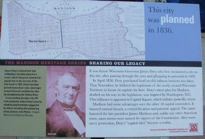
This city was planned in 1836
The Madison Heritage Series
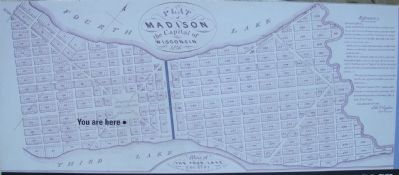
In April 1836, Doty purchased land on this isthmus between two lakes. That November, he lobbied the legislature of the newly created Wisconsin Territory to locate its capital city here. Doty’s street plan for Madison, drafted on his way to the legislature, was inspired by Washington, D.C. This influence is apparent in Capitol Square, which radiates spoke-like streets.
Madison had some advantages over the other 18 capital contenders. It boasted natural beauty, a central location and patriotic appeal: The name honored the late president James Madison and, unlike any other American town, most streets were named for signers of the Constitution. After some savvy promotion, Doty’s “capital idea” became a reality.
Sidebar:
James Doty’s original plat map of Madison included plans for a canal, which had great commercial appeal due to the success of the Erie Canal in 1825. Doty’s location proved impractical. Later, developer Leonard Farwell modified the idea by straightening the Yahara River.
In succeeding decades city officials gradually refined Doty’s plan by adopting improvements suggested by others including the pioneering urban planner John Nolen.
Erected 2006 by City of Madison.
Topics. This historical marker is listed in these topic lists: Government & Politics • Settlements & Settlers. A significant historical month for this entry is April 1836.
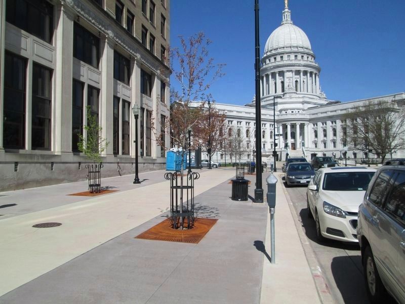
Location. 43° 4.415′ N, 89° 22.967′ W. Marker is in Madison, Wisconsin, in Dane County. Marker is on Martin Luther King, Jr. Boulevard, 0.1 miles south of West Main Street, on the right when traveling south. The marker is near the southeast corner of the M&I Bank building at 1 West Main Street. Touch for map. Marker is in this post office area: Madison WI 53703, United States of America. Touch for directions.
Other nearby markers. At least 8 other markers are within walking distance of this marker. David James Schaefer (about 400 feet away, measured in a direct line); U.S. Post Office and Courthouse (about 400 feet away); Hans Christian Heg (about 400 feet away); John A. Urich (about 400 feet away); Wisconsin State Capitol (about 500 feet away); Jackman Building (about 500 feet away); Smith and Lamb Block (about 500 feet away); Suhr Bank Building (about 500 feet away). Touch for a list and map of all markers in Madison.
More about this marker. This marker is part of the The Madison Heritage Series, Sharing Our Legacy, created for Madison's sesquicentennial. The marker was sponsored by the Madison Community Foundation and Kraft Foods/Oscar Mayer.
Also see . . . Movers & Shapers. Article naming Doty as one of the 10 most influential people in Madison history. (Submitted on July 12, 2010, by William J. Toman of Green Lake, Wisconsin.)
Credits. This page was last revised on April 26, 2021. It was originally submitted on July 11, 2010, by William J. Toman of Green Lake, Wisconsin. This page has been viewed 694 times since then and 19 times this year. Photos: 1, 2. submitted on July 11, 2010, by William J. Toman of Green Lake, Wisconsin. 3. submitted on April 25, 2021, by Jim Schaettle of Madison, Wisconsin. • Bill Pfingsten was the editor who published this page.


