Downtown in Omaha in Douglas County, Nebraska — The American Midwest (Upper Plains)
Captain William Clark and Private Reuben Field
Inscription.
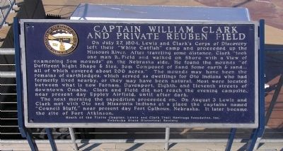
On July 27, 1804, Lewis and Clark's Corps of Discovery left their “White Catfish” camp and proceeded up the Missouri River. After traveling some distance, Clark “took one man R. Field and walked on Shore with a View of Examoning Som mounds” on the Nebraska side. He found the mounds “of Deffirent hight Shape & Size, Som Composed of Sand Some earth & sand....all of which covered about 200 acres.” The mounds may have been the remains of earthlodges, which served as dwellings for Oto Indians who had formerly lived nearby, or they may have been natural. Most were located between what in now Farnam, Davenport, Eight, and Eleventh streets of downtown Omaha. Clark and Field did not reach the evening campsite, near present day Eppley Airfield, until after dark.
The next morning the expedition proceeded on. On August 3 Lewis and Clark met with Oto and Missouria Indians at a place the captains named “Council Bluff,” near present day Fort Calhoun, Nebraska. It later became the site of Fort Atkinson.
Erected by Mouth of the Platte Chapter, Lewis and Clark Heritage Foundation, Inc. Nebraska State Historical Society. (Marker Number 428.)
Topics and series. This historical marker is listed in these topic lists: Exploration • Notable Events. In addition, it is included in the Lewis & Clark Expedition, and the Nebraska State Historical Society series lists. A significant historical date for this entry is July 27, 1804.
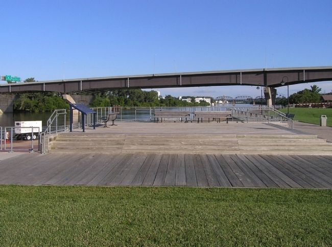
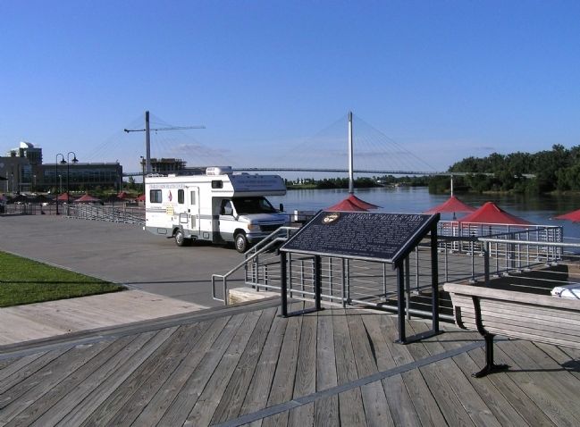
Location. 41° 15.682′ N, 95° 55.417′ W. Marker is in Omaha, Nebraska, in Douglas County. It is in Downtown. Marker can be reached from Riverfront Drive, 0.1 miles north of Dodge Street, on the right when traveling north. The marker is located on an observation deck at the Lewis and Clark Landing on the Missouri River. Touch for map. Marker is in this post office area: Omaha NE 68102, United States of America. Touch for directions.
Other nearby markers. At least 8 other markers are within walking distance of this marker. Union Walk (within shouting distance of this marker); Omaha Firefighters Memorial (about 600 feet away, measured in a direct line); Missouri River Flood (about 700 feet away); Labor (about 700 feet away); Trans-Mississippi and International Exposition of 1898 (approx. 0.2 miles away); People, Places, and Stories (approx. Ľ mile away); Preserving Our Heritage (approx. Ľ mile away); Westwardly by the Waters (approx. Ľ mile away). Touch for a list and map of all markers in Omaha.
Related markers. Click here for a list of markers that are related to this marker. To better understand the
relationship, study each marker in the order shown.
Credits. This page was last revised on February 16, 2023. It was originally submitted on July 12, 2010, by PaulwC3 of Northern, Virginia. This page has been viewed 1,438 times since then and 24 times this year. Photos: 1, 2, 3. submitted on July 12, 2010, by PaulwC3 of Northern, Virginia.


