Nancy Wrights Corner in Caroline County, Virginia — The American South (Mid-Atlantic)
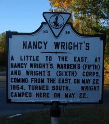
Nancy Wright’s
Erected 1927 by Conservation and Development Commission. (Marker Number E-28.)
Topics and series. This historical marker is listed in this topic list: War, US Civil. In addition, it is included in the Virginia Department of Historic Resources (DHR) series list. A significant historical month for this entry is May 1885.
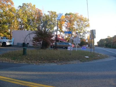
Location. 38° 5.393′ N, 77° 31.553′ W. Marker is in Nancy Wrights Corner, Virginia, in Caroline County. Marker is at the intersection of Jefferson Davis Hwy (U.S. 1) and Paige Road (Virginia Route 605), on the right when traveling north on Jefferson Davis Hwy. Touch for map. Marker is in this post office area: Woodford VA 22580, United States of America. Touch for directions.
Other nearby markers. At least 8 other markers are within 5 miles of this marker, measured as the crow flies. Spotsylvania County / Caroline County (approx. half a mile away); Turn in Sheridan’s Raid (approx. 1.2 miles away); Jerrell’s Mill (approx. 1.9 miles away); Mud Tavern (approx. 2.9 miles away); Stanard’s Mill (approx. 4.2 miles away); York: Lewis and Clark Expedition (approx. 4.8 miles away); Maneuvering to the North Anna River (approx. 4.8 miles away); Clark Family Farm (approx. 4.8 miles away).
Credits. This page was last revised on December 24, 2019. It was originally submitted on November 5, 2007, by Kevin W. of Stafford, Virginia. This page has been viewed 2,242 times since then and 62 times this year. Photos: 1, 2. submitted on November 5, 2007, by Kevin W. of Stafford, Virginia.

