Near Black River Falls in Jackson County, Wisconsin — The American Midwest (Great Lakes)
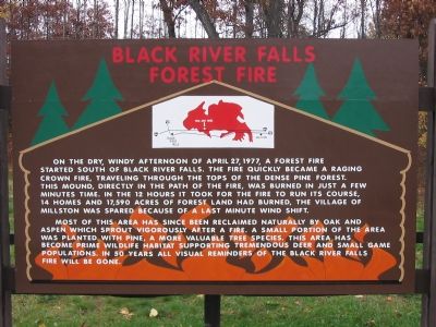
Black River Falls Forest Fire
Most of this area has since been reclaimed naturally by oak and aspen which sprout vigorously after a fire. A small portion of the area was planted with pine, a more valuable tree species. This area has become prime wildlife habitat supporting tremendous deer and small game populations. In 50 years all visual reminders of the Black River Falls fire will be gone.
Topics. This historical marker is listed in this topic list: Notable Events. A significant historical date for this entry is April 27, 1720.
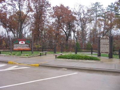
Location. 44° 14.872′ N, 90° 44.219′ W. Marker is near Black River Falls, Wisconsin, in Jackson County. Marker can be reached from Interstate 94 at milepost 121, on the right when traveling west. Marker is southeast of Black River Falls at westbound Rest Area 54. Touch for map. Marker is in this post office area: Black River Falls WI 54615, United States of America. Touch for directions.
Other nearby markers. At least 8 other markers are within 6 miles of this marker, measured as the crow flies. Black River Valley (within shouting distance of this marker); Highground Veterans Memorial (about 300 feet away, measured in a direct line); The Passenger Pigeon (about 300 feet away); Winnebago Indians (approx. 2.1 miles away); Sphagnum Moss (approx. 2.1 miles away); Martin W. Torkelson (approx. 5.8 miles away); Mitchell Red Cloud, Jr. (approx. 6 miles away); Andrew Blackhawk (approx. 6.1 miles away). Touch for a list and map of all markers in Black River Falls.
Credits. This page was last revised on June 16, 2016. It was originally submitted on November 5, 2007, by Keith L of Wisconsin Rapids, Wisconsin. This page has been viewed 3,505 times since then and 120 times this year. Photos: 1, 2. submitted on November 5, 2007, by Keith L of Wisconsin Rapids, Wisconsin. • Kevin W. was the editor who published this page.

