Marker Logo HMdb.org THE HISTORICAL
MARKER DATABASE
“Bite-Size Bits of Local, National, and Global History”
Near Austell in Cobb County, Georgia — The American South (South Atlantic)
 

Sweet Water Town Site


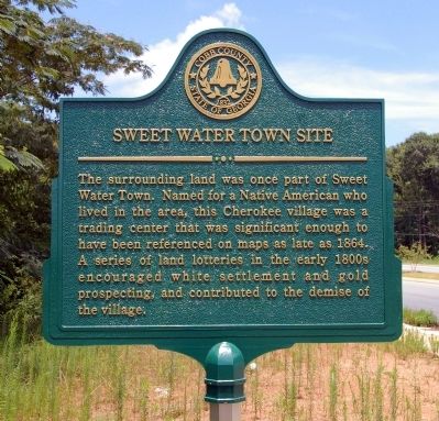
Sweet Water Town Site Marker image. Click for full size.
Photographed By David Seibert, July 19, 2010
1. Sweet Water Town Site Marker
Inscription. The surrounding land was once part of Sweet Water Town. Named for a Native American who lived in the area, this Cherokee Village was a trading center that was significant enough to have been referenced on maps as late as 1864. A series of land lotteries in the early 1800s encouraged white settlement and gold prospecting, and contributed to the demise of the village.
 
Erected 2010 by Cobb County Community Development Agency.
 
Topics. This historical marker is listed in these topic lists: Industry & CommerceNative AmericansSettlements & Settlers. A significant historical year for this entry is 1864.
 
Location. 33° 48.167′ N, 84° 37.2′ W. Marker is near Austell, Georgia, in Cobb County. Marker is on Maxham Road, 0.1 miles north of Old Alabama Road, on the right when traveling south. Touch for map. Marker is in this post office area: Austell GA 30168, United States of America. Touch for directions.
 
Other nearby markers. At least 8 other markers are within 3 miles of this marker, measured as the crow flies. Causey - Maxham House (approx. half a mile away); Clarkdale Mill Village Historic District (approx. 2.6 miles away); Turner's, Howell's Baker's & Sandtown Ferries (approx. 2.7 miles away); Clarkdale Historic District (approx. 2.8 miles away); The Mitchell House
Paid Advertisement
Click on the ad for more information.
Please report objectionable advertising to the Editor.
Click or scan to see
this page online
(approx. 2.8 miles away); Toward the River (approx. 2.8 miles away); Coats & Clark Thread Mill (approx. 2.8 miles away); The Mable House (approx. 3.1 miles away).
 
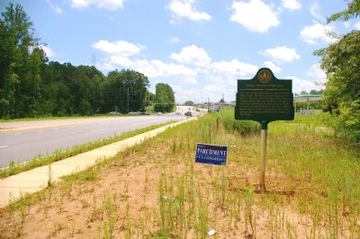
Sweet Water Town Site Marker image. Click for full size.
Photographed By David Seibert, July 19, 2010
2. Sweet Water Town Site Marker
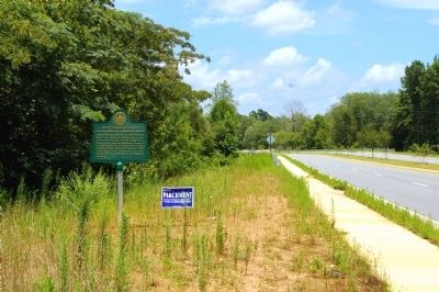
Sweet Water Town Site Marker image. Click for full size.
Photographed By David Seibert, July 19, 2010
3. Sweet Water Town Site Marker
Looking south on Maxham Road, toward Old Alabama Road
Sweet Water Town Site Marker image. Click for full size.
Photographed By David Seibert, July 19, 2010
4. Sweet Water Town Site Marker
Looking north on Maxham Road, toward the Causey-Maxham House
 
 
Credits. This page was last revised on May 7, 2020. It was originally submitted on July 22, 2010, by David Seibert of Sandy Springs, Georgia. This page has been viewed 1,372 times since then and 54 times this year. Photos:   1, 2, 3, 4. submitted on July 22, 2010, by David Seibert of Sandy Springs, Georgia. • Craig Swain was the editor who published this page.
Share this page.  
Share on Tumblr
m=33422

CeraNet Cloud Computing sponsors the Historical Marker Database.
This website earns income from purchases you make after using our links to Amazon.com. We appreciate your support.
Paid Advertisement
Apr. 25, 2024