Irwin in Westmoreland County, Pennsylvania — The American Northeast (Mid-Atlantic)
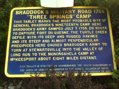
Braddock's Military Road 1755
"Three Springs" Camp
Inscription.
This tablet marks the most probable site of General Braddock's nineteenth camp. Here Braddock's army camped July 7, 1755, en route to capture Fort Du Quesne. The Turtle Creek defile with its deep and rugged ravines, and its steep and almost perpendicular precipices here caused Braddock's army to turn at Stewartsville into the valley of Long Run to the Monongahela camp at McKeesport about eight miles distant.
Erected 1932.
Topics and series. This historical marker is listed in these topic lists: Colonial Era • Roads & Vehicles • War, French and Indian. In addition, it is included in the Braddock’s Road and Maj. Gen. Edward Braddock series list. A significant historical date for this entry is July 7, 1779.
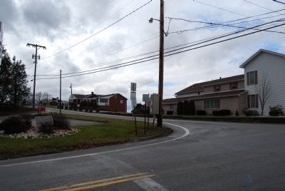
Location. 40° 19.67′ N, 79° 44.255′ W. Marker is in Irwin, Pennsylvania, in Westmoreland County. Marker is at the intersection of Clay Pike and Robbins Station Road on Clay Pike. Marker is low to the ground between shrubs under the sign for the First National Bank at the corner of Clay Pike and Robbins Station Road. Touch for map. Marker is at or near this postal address: 200 Clay Pike, Irwin PA 15642, United States of America. Touch for directions.
Other nearby markers. At least 8 other markers are within 5 miles of this marker, measured as the crow flies. Long Run Church (approx. ¼ mile away); John Irwin House (approx. 1.4 miles away); The Beginning of the Lincoln Highway (approx. 1.4 miles away); Fort Reburn (approx. 2.6 miles away); Fort Walthour (approx. 2.8 miles away); Braddock's Military Road 1755 Monacatootha's Camp (approx. 3.1 miles away); Arthur J. Rooney (approx. 3.9 miles away); Trafford's Fallen Heroes (approx. 4.1 miles away). Touch for a list and map of all markers in Irwin.
Credits. This page was last revised on December 10, 2019. It was originally submitted on July 20, 2010, by William Richard Harrison of Pittsburgh, Pennsylvania. This page has been viewed 3,371 times since then and 62 times this year. Last updated on July 25, 2010, by William Richard Harrison of Pittsburgh, Pennsylvania. Photos: 1. submitted on July 20, 2010, by William Richard Harrison of Pittsburgh, Pennsylvania. 2. submitted on January 4, 2015, by Mike Wintermantel of Pittsburgh, Pennsylvania. • Bill Pfingsten was the editor who published this page.

