Near Elmira in Chemung County, New York — The American Northeast (Mid-Atlantic)
Fire on the Frontier - 1778
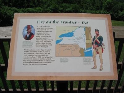
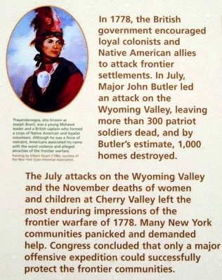
In 1778, the British government encouraged loyal colonists and Native American allies to attack frontier settlements. In July, Major John Butler led an attack on the Wyoming Valley, leaving more than 300 patriot soldiers dead, and by Butler's estimate, 1,000 homes destroyed.
The July attacks on the Wyoming Valley and the November deaths of women and children at Cherry Valley left the most enduring impressions of the frontier warfare of 1778. Many New York communities panicked and demanded help. Congress concluded that only a major offensive expedition could successfully protect the frontier communities.
(Upper Left Sidebar):
Thayendanegea, also known as Joseph Brant, was a young Mohawk leader and a British captain who formed a corps of Native American and loyalist volunteers. Although he was a force of restraint, Americans associated his name with the worst violence and alleged atrocities of the frontier warfare.
(Right Sidebar):
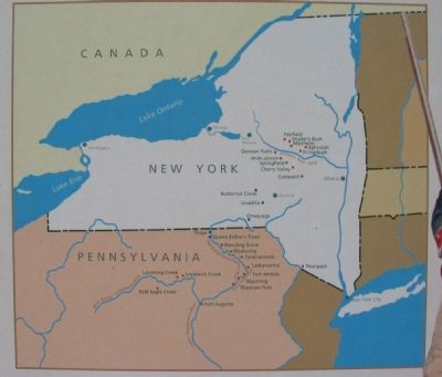
Periodic attacks on the frontiers of New York and Pennsylvania in 1778 terrified exposed communities and prompted appeals to Congress to send Continental soldiers to aid in their defense.
In late 1777, Major John Butler assembled loyal colonists who had fled New York's Mohawk Valley. Butler's Rangers (depicted here) repeatedly attacked the frontier communities of New York and Pennsylvania throughout the rest of the war.
Topics. This historical marker is listed in these topic lists: Native Americans • War, US Revolutionary. A significant historical year for this entry is 1778.
Location. 42° 2.667′ N, 76° 43.966′ W. Marker is near Elmira, New York, in Chemung County. Marker is on Newtown Reservation Road. Located at Newtown Battlefield Reservation State Park. Touch for map. Marker is in this post office area: Elmira NY 14901, United States of America. Touch for directions.
Other nearby markers. At least 10 other markers are within walking distance of this marker. The Sullivan Campaign (here, next to this marker); The Battle of Newtown (here, next to this marker); Divided Peoples (a few steps from this marker); Major General John Sullivan (within shouting distance of this marker); Flagstaffs - Newtown Battlefield (about 300 feet away, measured in a direct line); a different marker also named The Battle of Newtown (about 400 feet away); Newtown Battlefield Reservation (about 500 feet away); A Civil Rights Victory (about 700 feet away); Newtown (approx. 0.4 miles away); Routes of the Armies / Newtown 1779 (approx. 0.8 miles away). Touch for a list and map of all markers in Elmira.
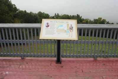
More about this marker. On the left is a portrait of Joseph Brant. On the right is a depiction of a Ranger of Butler's command. A map of New York and Pennsylvania indicates
key points along the frontier.
Also see . . . Joseph Brant. Wikipedia article. (Submitted on July 25, 2010, by Craig Swain of Leesburg, Virginia.)
Credits. This page was last revised on June 16, 2016. It was originally submitted on July 25, 2010, by Craig Swain of Leesburg, Virginia. This page has been viewed 1,104 times since then and 30 times this year. Photos: 1. submitted on July 25, 2010, by Craig Swain of Leesburg, Virginia. 2. submitted on March 4, 2016, by Scott J. Payne of Deposit, New York. 3. submitted on July 25, 2010, by Craig Swain of Leesburg, Virginia. 4, 5, 6. submitted on November 6, 2015, by Brian Scott of Anderson, South Carolina. 7. submitted on July 25, 2010, by Craig Swain of Leesburg, Virginia. 8, 9. submitted on November 6, 2015, by Brian Scott of Anderson, South Carolina.
