Buena Vista in Southeast Washington in Washington, District of Columbia — The American Northeast (Mid-Atlantic)
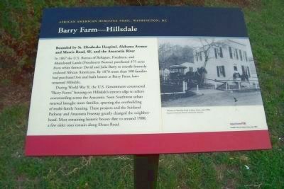
Barry Farm - Hillsdale
Bounded by St. Elizabeths Hospital, Alabama Avenue and Morris Road, SE, and the Anacostia River
— African American Heritage Trail, Washington DC —
In 1867 the U.S. Bureau of Refugees, Freedmen, and Abandoned Lands (Freedmen’s Bureau) purchased 375 acres from white farmers David and Julia Barry to resettle formerly enslaved African Americans. By 1870 more than 500 families had purchased lots and built homes at Barry Farm, later renamed Hillsdale.
During World War II, the U.S. Government constructed “Barry Farms” housing on Hillsdale’s eastern edge to relieve overcrowding across the Anacostia [River]. Soon, Southwest [DC] urban renewal brought more families, spurring the over building of multi-family housing. These projects and the Suitland Parkway and Anacostia Freeway greatly changed the neighborhood. Most remaining historic houses date to around 1900; a few older ones remain along Elvans Road.
Erected by Cultural Tourism DC.
Topics and series. This historical marker is listed in these topic lists: African Americans • Government & Politics • Settlements & Settlers. In addition, it is included in the African American Heritage Trail series list. A significant historical year for this entry is 1867.
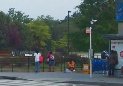
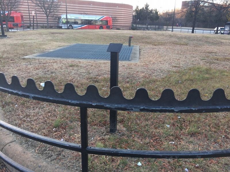
Location. Marker has been reported missing. It was located near 38° 51.73′ N, 76° 59.693′ W. Marker was in Southeast Washington in Washington, District of Columbia. It was in Buena Vista. Marker was on Howard Road Southeast west of Martin Luther King, Jr. Avenue Southeast, on the right when traveling east. Marker is off the sidewalk at the northeast corner of DC Metro's Anacostia station, on Howard Road between Firth Sterling and MLK, Jr. Avenues, SE. Touch for map. Marker was at or near this postal address: 1101 Howard Road Southeast, Washington DC 20020, United States of America. Touch for directions.
Other nearby markers. At least 8 other markers are within walking distance of this location. A Navy Town (within shouting distance of this marker); Faith and Action (about 400 feet away, measured in a direct line); Nichols Avenue Elementary School / Old Birney School Site (about 400 feet away); Birney School (about 500 feet away); Bethlehem Baptist Church (about 500 feet away); A Museum for the Community (about 700 feet away); Roads That Divide (approx. 0.2 miles away); Barry Farm Dwellings (approx. 0.2 miles away). Touch for a list and map of all markers in Southeast Washington.
More about this marker.
[Photo caption:]
A home on Sheridan Road in Barry Farm, early 1900s.
Anacostia Community Museum, Smithsonian Institution.
Also see . . .
1. Suitland Parkway. (Submitted on July 29, 2010, by Richard E. Miller of Oxon Hill, Maryland.)
2. Barry Farm Site, African American Heritage Trail. (Submitted on January 16, 2018, by Devry Becker Jones of Washington, District of Columbia.)
Additional keywords.
Reconstruction Era; Uniontown; Ward 8; housing segregation; urban decay; Martha Jackson-Jarvis.
Photographed By Richard E. Miller, July 3, 2009
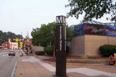
3. The Anacostia Metro Station
The Barry Farm-Hillsdale Marker is at its northeastern end, past the crosswalk, left middle. Note the acclaimed glass mosaic frieze by Martha Jackson-Jarvis, "River Spirits of the Anacostia" decorating the facility's roof-line, upper right.
Photographed By Richard E. Miller, October 7, 2009
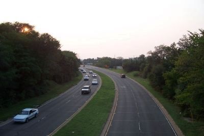
4. View toward downtown Washington from the Suitland Parkway-MLK Ave overpass, southeast of the marker.
Changes wrought by construction of the parkway (begun in 1944) and subsequent high density housing projects for the poor are said to mark the start of Barry Farm-Hillsdales's decline from its beginnings as a thriving, semi-rural Afro-American community.
Credits. This page was last revised on January 30, 2023. It was originally submitted on July 29, 2010, by Richard E. Miller of Oxon Hill, Maryland. This page has been viewed 1,922 times since then and 20 times this year. Last updated on February 2, 2018, by Devry Becker Jones of Washington, District of Columbia. Photos: 1, 2, 3, 4. submitted on July 29, 2010, by Richard E. Miller of Oxon Hill, Maryland. 5. submitted on February 2, 2018, by Devry Becker Jones of Washington, District of Columbia. • Bill Pfingsten was the editor who published this page.
