Phoebus in Hampton, Virginia — The American South (Mid-Atlantic)
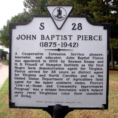
John Baptist Pierce
(1875-1942)
Erected 1983 by Virginia Historic Landmarks Commission. (Marker Number S-28.)
Topics and series. This historical marker is listed in these topic lists: African Americans • Agriculture • Education. In addition, it is included in the Historically Black Colleges and Universities, and the Virginia Department of Historic Resources (DHR) series lists. A significant historical year for this entry is 1906.
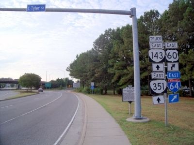
Location. 37° 1.433′ N, 76° 19.871′ W. Marker is in Hampton, Virginia. It is in Phoebus. Marker is at the intersection of Settlers Landing Road (U.S. 60) and East Tyler Street, on the right when traveling east on Settlers Landing Road. Touch for map. Marker is in this post office area: Hampton VA 23669, United States of America. Touch for directions.
Other nearby markers. At least 8 other markers are within walking distance of this marker. Emancipation Oak (within shouting distance of this marker); Hampton Institute (about 300 feet away, measured in a direct line); a different marker also named Emancipation Oak (about 300 feet away); Second Church at Kecoughtan (approx. 0.2 miles away); First Church at Kecoughtan (approx. 0.2 miles away); This Wall (approx. 0.2 miles away); Second Church at Kecoughton (approx. 0.2 miles away); Phoebus (approx. 0.2 miles away). Touch for a list and map of all markers in Hampton.
Credits. This page was last revised on February 1, 2023. It was originally submitted on August 1, 2010, by Bernard Fisher of Richmond, Virginia. This page has been viewed 746 times since then and 25 times this year. Photos: 1, 2. submitted on August 1, 2010, by Bernard Fisher of Richmond, Virginia.

