Jenkins in Newport News, Virginia — The American South (Mid-Atlantic)
Mathews Mill
An Ancient Mill Type
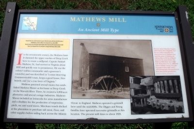
Newport News was a small community located in Warwick County until late in the 19th century. Established as a town in 1880, it was incorporated as a city in 1896. Warwick County, one of the eight original Virginia shires formed by 1634, became extinct in 1952 when it was designated the city of Warwick. It merged with Newport News in 1958.
In the seventeenth century, the Mathews family dammed the upper reaches of Deep Creek here to create a millpond. Captain Samuel Mathews, Sr., had arrived in Virginia about 1622 and quickly rose to prominence. He was the colony’s militia commander and a governor’s councilor, and was described as “a most deserving Common-wealth’s man, keeps a good house, lives bravely, and [is] a true lover of Virginia.”
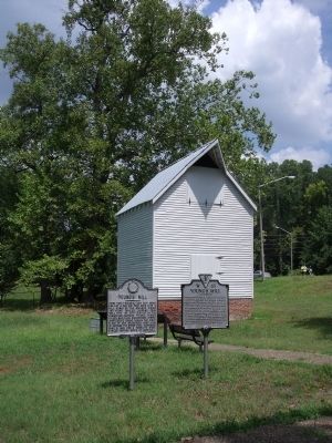
Mathews patented several estates but established Mathews Manor as his home at Deep Creek on the Warwick River. There, he created a 5,000-acre plantation and several cottage industries. Mathews Manor included an ironworks for arms manufacture and a distillery for the production of turpentine, pitch, tar, and naval stores. Merchant vessels docked at the plantation to purchase salt meat, flour, and other supplies before sailing back across the Atlantic Ocean to England. Mathews operated a gristmill here until the mid-1600s. The Digges and Young families later operated successive gristmills at this location. The present mill dates to about 1820.
Erected by Newport News Founders Trail.
Topics. This historical marker is listed in these topic lists: Colonial Era • Industry & Commerce • Settlements & Settlers. A significant historical year for this entry is 1880.
Location. 37° 6.369′ N, 76° 30.838′ W. Marker is in Newport News, Virginia. It is in Jenkins. Marker can be reached from the intersection of Old Grist Mill Lane and Warwick Boulevard (U.S. 60). Touch for map. Marker is in this post office area: Newport News VA 23602, United States of America. Touch for directions.
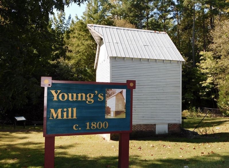
Other nearby markers. At least 8 other markers are within 3 miles of this marker, measured as the crow flies. Young’s Mill (here, next to this marker); a different marker also named Young’s Mill (here, next to this marker); a different marker also named Young’s Mill (here, next to this marker); First Peninsula Defense Line (within shouting distance of this marker); Providence Mennonite Church (approx. 0.2 miles away); Denbigh Parish (approx. ¼ mile away); Two USCT Heroes (approx. 1.1 miles away); Reflecting a Changing Society (approx. 2.2 miles away). Touch for a list and map of all markers in Newport News.
More about this marker. On the right are two photos with the caption, "Because many Tidewater Virginia watercourses flow sluggishly
near the sea, mills frequently were constructed (as in England) that used the power of flowing and ebbing tides to fill the millpond and turn the waterwheels. The Mathews Mill likely was a tidal mill. Shown here is a ca. 1790 tidal mill in Suffolk County, N.Y., photographed about 1920, with a 1975 photograph of the gears inside that powered the grindstones." Courtesy Library of Congress
Credits. This page was last revised on February 1, 2023. It was originally submitted on August 1, 2010, by Bernard Fisher of Richmond, Virginia. This page has been viewed 956 times since then and 21 times this year. Photos: 1, 2. submitted on August 1, 2010, by Bernard Fisher of Richmond, Virginia. 3. submitted on October 31, 2021, by Bradley Owen of Morgantown, West Virginia.


