Mt. Horeb in Dane County, Wisconsin — The American Midwest (Great Lakes)
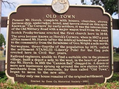
Old Town
Scotch Presbyterians erected the first church here in 1848.
The area became known as Horeb’s Corners, when in 1867 a post office named Mt. Horeb (after the biblical landmark) was moved to the community from the farmhome of Geo. Wright a mile north.
Norwegians, three-fourths of the population by 1875, called the settlement STANGJII (Liberty Pole) for the flag pole erected here in Civil War years.
Railroad engineers, unable to find a suitable site in the pioneer village, built a depot a mile to the west, in the heart of present day Mt. Horeb. In 1881 the “Cannon Ball” chugged in. A dozen or more new businesses sprang up around the new station before merchants from the crossroads, by then called “Old Town,” began to move to the new site.
Today only one house remains of the original settlement.
Erected 1980 by Dane County Historical Society. (Marker Number 18.)
Topics and series. This historical marker is listed in this topic list: Settlements & Settlers. In addition, it is included in the Wisconsin, Dane County Historical Society series list. A significant historical year for this entry is 1848.
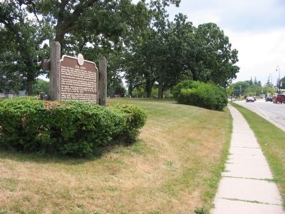
Location. 43° 0.68′ N, 89° 43.802′ W. Marker is in Mt. Horeb, Wisconsin, in Dane County. Marker is on State Highway 78, 0.1 miles north of County Road ID, on the right when traveling north. Marker is located at Mt. Horeb Union Cemetery. Touch for map. Marker is in this post office area: Mount Horeb WI 53572, United States of America. Touch for directions.
Other nearby markers. At least 8 other markers are within 6 miles of this marker, measured as the crow flies. Springdale Lutheran Church (approx. 2 miles away); German Valley (approx. 3.7 miles away); Donald Park (approx. 4.2 miles away); Brigham Park (approx. 4.6 miles away); a different marker also named Brigham Park (approx. 4.6 miles away); Blue Mounds Fort (approx. 4.9 miles away); Site of Blue Mounds Fort (approx. 5.1 miles away); Elvers Corner (approx. 5.3 miles away).
Regarding Old Town. When completed in 1837, Military Road was used for the transportation of supplies and mail from Fort Howard, the army post at Green Bay, to Fort Winnebago at Portage and Fort Crawford at Prairie du Chien.
Additional keywords. Mount Horeb
Credits. This page was last revised on June 16, 2016. It was originally submitted on August 29, 2007, by Keith L of Wisconsin Rapids, Wisconsin. This page has been viewed 2,329 times since then and 51 times this year. Last updated on August 1, 2010, by William J. Toman of Green Lake, Wisconsin. Photos: 1, 2. submitted on August 29, 2007, by Keith L of Wisconsin Rapids, Wisconsin. • Kevin W. was the editor who published this page.

