Downtown in Hampton, Virginia — The American South (Mid-Atlantic)
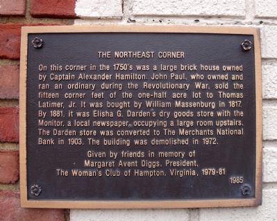
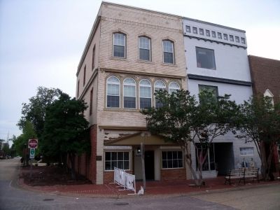
The Northeast Corner
Erected 1985 by friends in memory of Margaret Avent Diggs, President, The Woman's Club of Hampton, Virginia, 1979-81.
Topics. This historical marker is listed in these topic lists: Colonial Era • Industry & Commerce • Notable Buildings • War, US Revolutionary. A significant historical year for this entry is 1817.
Location. 37° 1.549′ N, 76° 20.647′ W. Marker is in Hampton, Virginia. It is in Downtown. Marker is at the intersection of East Queens Way and Kings Way, on the right when traveling west on East Queens Way. Touch for map. Marker is in this post office area: Hampton VA 23669, United States of America. Touch for directions.
Other nearby markers. At least 8 other markers are within walking distance of this marker. King and Queen Streets (here, next to this marker); The Sclater Building (a few steps from this marker); The Southeast Corner (a few steps from this marker); The Southwest Corner (a few steps from this marker); F.W. Woolworth Co. Building (within shouting distance of this marker); McDowell's Inn (within shouting distance of this marker); The Masonic Temple (within shouting distance of this marker); The Magnolia Tree Inn (about 300 feet away, measured in a direct line). Touch for a list and map of all markers in Hampton.
Credits. This page was last revised on February 1, 2023. It was originally submitted on August 2, 2010, by Bernard Fisher of Richmond, Virginia. This page has been viewed 898 times since then and 9 times this year. Photos: 1, 2. submitted on August 2, 2010, by Bernard Fisher of Richmond, Virginia.

