Wythe in Hampton, Virginia — The American South (Mid-Atlantic)
Indian River Park – In The Heart Of Olde Wythe
“A Forward Movement in Suburban Development”
Inscription.
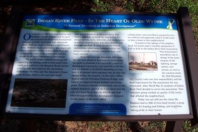
On this site in 1916 local businessman and developer Charles Hopkins and his partners launched the Boulevard Development Company, to build “attractive, high class home places” half way between Hampton and Newport News. With the local connection to this area’s rich Native American history, Indian River Park was chosen as the name of the subdivision and its streets would carry references to this history.
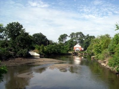
The park’s design included dredging and expanding the existing creek so that small boats could go in and out to the Hampton Roads harbor. A trolley stop was created at the intersection of Powhatan Parkway and The Boulevard (Chesapeake Avenue), where a five cent fare would take you to Hampton or Newport News. The Park’s amenities included the installation of a sewage system, curbs, sidewalks, and street lights, as well as common areas that were planted with trees and gardens. To keep the streets free of obstructions, alleys were designed behind the homes to handle utilities, telephone lines, and trash removal.
From May through December 1916 enticing ads were placed in local papers encouraging the public to purchase a lot and build a home in the planned community. Lots sized 50 x 150 feet sold for $450.00 to $1,250.00 depending on location. A 10 percent down payment was all that was needed to buy the property. At the sales’ office located near the Powhatan Parkway Bridge, were lists of pre-approved home builders and house plans. To ensure that the homes built were to the highest standard, each lot deed specified that the cost of a home be at least $3,000.00, and that plans be approved by the development company. On the porch of the sales’ office rocking chairs were provided so prospective buyers could sit and appreciate what it would mean to have a home in this neighborhood.
To preserve the upkeep of the neighborhood, lot owners paid a monthly assessment of $.25 to $.35 to the Indian River Park Association. This homeowners’ association was in charge of the maintenance of the lighting, sewage system, and streets, as well as the common areas. By 1940 Elizabeth City County took over this responsibility and the deed requirement for the assessment fee wash eliminated. After World War II residents of Indian River Park decided to revive the association. This volunteer group worked on quality of life issues that affected the neighborhood.
Today one can still see the vision Mr. Hopkins had in 1916 of tree-lined streets, a snug harbor for boating and fishing, and neighbors taking pride in their homes.
Bringing History to Life
For more neighborhood information visit: www.oldewythe.com
For more visitor information visit: www.VisitHampton.com
In partnership with Virginia Civil War Trails, www.civilwartrails.org
Erected by Olde Wythe Neighborhood Association.
Topics. This historical marker is listed in these topic lists: Industry & Commerce • Parks & Recreational Areas • Roads & Vehicles • Settlements & Settlers. A significant historical year for this entry is 1916.
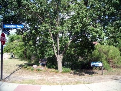
Location. 36° 59.987′ N, 76° 22.403′ W. Marker is in Hampton, Virginia. It is in Wythe. Marker is at the intersection of Chesapeake Avenue (Virginia Route 167) and Powhatan Parkway, on the right when traveling south on Chesapeake Avenue. Touch for map. Marker is in this post office area: Hampton VA 23661, United States of America. Touch for directions.
Other nearby markers. At least 8 other markers are within walking distance of this marker. Sack of Hampton / The War of 1812 (here, next to this marker); The Hampton Roads Golf And Country Club (approx. ¼ mile away); Hampton Roads – World’s Greatest Harbor (approx. 0.3 miles away); Admiral Sir George Cockburn on the Chesapeake / The War of 1812 (approx. 0.3 miles away); Olde Wythe During Colonial Times (approx. 0.4 miles away); The Development Of Olde Wythe (approx. half a mile away); Fertile Hunting Grounds For The Indians (approx. 0.6 miles away); Stalemate in Hampton Roads (approx. 0.7 miles away). Touch for a list and map of all markers in Hampton.
More about this marker. On the lower left is a "1924 photo showing the location of Indian River Park in rural Elizabeth County."
On the upper right is a photo of the "Entrance to Indian River Park from Chesapaeke Avenue."
Also see . . .
1. Memories and History of Hampton Virginia’s Olde Wythe Neighborhood. (Submitted on August 2, 2010, by Bernard Fisher of Richmond, Virginia.)
2. Hampton Convention & Visitor Bureau. (Submitted on August 2, 2010, by Bernard Fisher of Richmond, Virginia.)
3. Virginia Civil War Trails. (Submitted on August 2, 2010, by Bernard Fisher of Richmond, Virginia.)
Credits. This page was last revised on February 1, 2023. It was originally submitted on August 2, 2010, by Bernard Fisher of Richmond, Virginia. This page has been viewed 879 times since then and 43 times this year. Photos: 1, 2, 3. submitted on August 2, 2010, by Bernard Fisher of Richmond, Virginia.


