Near Middletown in Frederick County, Virginia — The American South (Mid-Atlantic)
Union Trenches

Photographed By Craig Swain, September 29, 2007
1. Union Trenches Marker
A Virtual Tour of the Battle of Cedar Creek by related HMDb markers.
Click for more information.
Click for more information.
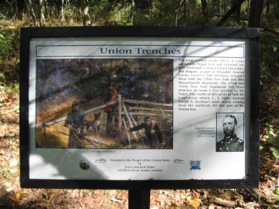
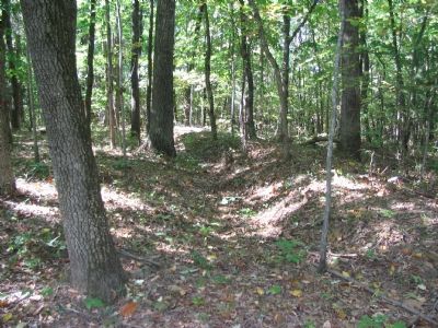
The main portion of the XIX U.S. Corps earthworks began here and extended one mile westward. Colonel Daniel Macaulay's 3rd Brigade, a part of Brigadier General Cuvier Grover's 2nd Division, occupied them with the 128th New York and 38th Massachusetts Regiments. The 176th and 156th New York Regiments left these trenches to form a line parallel to the Valley Pike north of this point to halt the Confederate attack. C.S. Major General Joseph B. Kershaw's main attack, coming from the southeast, hit this part of the federal line.
by
Joyce and Jack Keller
of Hilton Head, South Carolina
Erected by Blue and Gray Education Society and Cedar Creek Battlefield Foundation.
Topics. This historical marker is listed in this topic list: War, US Civil.
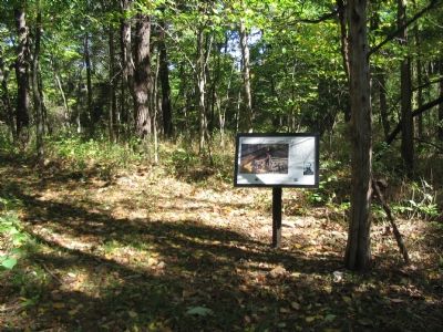
Location. 39° 0.751′ N, 78° 18.664′ W. Marker is near Middletown, Virginia, in Frederick County. Marker can be reached from Valley Pike (U.S. 11), on the right when traveling south. Located along the walking trail of the XIX Corps Earthworks, preserved by the Cedar Creek Battlefield Foundation. Touch for map. Marker is in this post office area: Middletown VA 22645, United States of America. Touch for directions.
Other nearby markers. At least 8 other markers are within walking distance of this marker. 1st Maine Battery (within shouting distance of this marker); South Carolina Troops at Cedar Creek (about 700 feet away, measured in a direct line); Molineux's 2nd Brigade (approx. 0.2 miles away); Union Withdrawal (approx. ¼ mile away); Battle of Cedar Creek (approx. ¼ mile away); 128th New York Volunteer Regiment (approx. ¼ mile away); Outflanked! (approx. ¼ mile away); Bearing the Brunt (approx. ¼ mile away). Touch for a list and map of all markers in Middletown.
More about this marker. In the center of the marker is a painting titled, "Infantry Skirmishers." On the right is a portrait of "Brigadier General Cuvier Grover, 2nd Division, XIX U.S. Corps."
Regarding Union Trenches. The Cedar Creek battlefield is interpreted by several markers. See the Battle of Cedar Creek Virtual Tour by Markers link above.
Also see . . .
1. Battle of Cedar Creek Staff Ride. The trail extends from tour stop four on the Center of Military History staff ride of the battle. (Submitted on November 7, 2007, by Craig Swain of Leesburg, Virginia.)
2. Battle of Cedar Creek Summary
. The action here is discussed as phase four of the National Parks Service summary of the battle. (Submitted on November 7, 2007, by Craig Swain of Leesburg, Virginia.)

Photographed By Craig Swain, September 29, 2007
3. Corner of Grover's Line
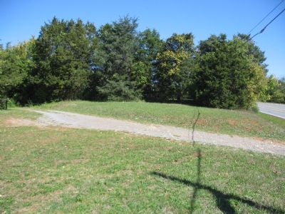
Here at a point adjacent to the Valley Pike, Grover posted Mccauley's Brigade, with the 128th New York and 38th Massachusetts extending to the left of the photo; The 156th and 176th New York Regiments formed along the Valley Pike, extending away from the camera's point of view.
Credits. This page was last revised on July 6, 2023. It was originally submitted on November 7, 2007, by Craig Swain of Leesburg, Virginia. This page has been viewed 2,089 times since then and 42 times this year. Photos: 1, 2, 3, 4. submitted on November 7, 2007, by Craig Swain of Leesburg, Virginia.

