Edgewater in Anne Arundel County, Maryland — The American Northeast (Mid-Atlantic)
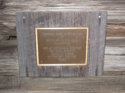
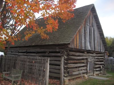
Tobacco Barn
Erected 1980 by Ann of Arundell Chapter, National Society Colonial Dames of the XVII Century.
Topics and series. This historical marker is listed in this topic list: Colonial Era. In addition, it is included in the The Colonial Dames XVII Century, National Society series list. A significant historical year for this entry is 1720.
Location. 38° 56.475′ N, 76° 32.43′ W. Marker is in Edgewater, Maryland, in Anne Arundel County. Marker can be reached from Londontown Road, 1.3 miles east of Mayo Road (Route 253). Marker is on the grounds of London Town Park, at the end of Londowntown Road. Touch for map. Marker is in this post office area: Edgewater MD 21037, United States of America. Touch for directions.
Other nearby markers. At least 8 other markers are within walking distance of this marker. Historic London Town and Gardens (here, next to this marker); The Lord Mayor's Tenement (within shouting distance of this marker); Dr. Hill's Medicinal Plants (within shouting distance of this marker); London Town Publik House (within shouting distance of this marker); Archaeology at London Town (within shouting distance of this marker); Establishing a Colonial Town (within shouting distance of this marker); William Brown House (within shouting distance of this marker); London Town Ferry (within shouting distance of this marker). Touch for a list and map of all markers in Edgewater.

Photographed By F. Robby, December 30, 2003
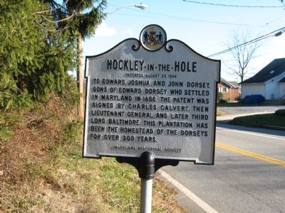
3. Hockley-in-the-Hole Marker
This marker which describes the plantation where the barn was built is located in Annapolis at the intersection of Defense Highway (MD 450) and Nichols Road, about 4.5 miles due north of London Town.
Click for more information.
Click for more information.
Credits. This page was last revised on June 16, 2016. It was originally submitted on November 9, 2007, by F. Robby of Baltimore, Maryland. This page has been viewed 1,418 times since then and 20 times this year. Photos: 1, 2, 3. submitted on November 9, 2007, by F. Robby of Baltimore, Maryland. • J. J. Prats was the editor who published this page.

