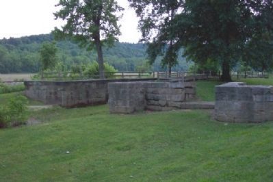
Nelsonville in Athens County, Ohio — The American Midwest (Great Lakes)
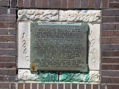
Hocking Canal Site
1840–1940
This early waterway, a tremendous factor in the industrial development of the Hocking Coal District of Ohio, was completed to this point in September, 1840, when the first boatload of “stone coal” was shipped by canal to market. Although succeeded by the railroad in 1869, the canal served a full half-century of usefulness before abandonment.
This section of the highway was dedicated October 26th, 1940, just 100 years after completion of the canal.
C. D. Shafer • C. G. Dew, Mayor • A. B. Wells
Erected 1940.
Topics. This historical marker is listed in these topic lists: Roads & Vehicles • Waterways & Vessels. A significant historical month for this entry is September 1840.
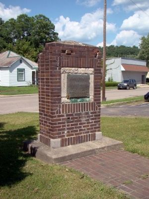
Location. 39° 27.683′ N, 82° 14.417′ W. Marker is in Nelsonville, Ohio, in Athens County. Marker is at the intersection of Canal Street (U.S. 33) and Washington Street, on the left when traveling east on Canal Street. Touch for map. Marker is in this post office area: Nelsonville OH 45764, United States of America. Touch for directions.
Other nearby markers. At least 8 other markers are within walking distance of this marker. Camp Site of Lord Dunmore (about 500 feet away, measured in a direct line); Nelsonville (approx. 0.2 miles away); Hocking Valley Railway (approx. 0.4 miles away); Daniel Nelson (approx. 0.4 miles away); E. M. Poston (approx. 0.4 miles away); The Hocking Valley Coal Strike (approx. 0.4 miles away); Fort Street Cemetery (approx. half a mile away); Unknown Soldier Monument (approx. half a mile away). Touch for a list and map of all markers in Nelsonville.
Regarding Hocking Canal Site. Hocking Canal was connected to Ohio & Erie at Carroll, Ohio.
Credits. This page was last revised on September 24, 2020. It was originally submitted on August 30, 2008, by J. J. Prats of Powell, Ohio. This page has been viewed 2,475 times since then and 21 times this year. Last updated on August 9, 2010, by David Meyer of Canal Winchester, Ohio. Photos: 1, 2. submitted on August 30, 2008, by J. J. Prats of Powell, Ohio. 3, 4, 5. submitted on June 28, 2009, by William Fischer, Jr. of Scranton, Pennsylvania. • Kevin W. was the editor who published this page.
