Near Johnson Siding in Pennington County, South Dakota — The American Midwest (Upper Plains)
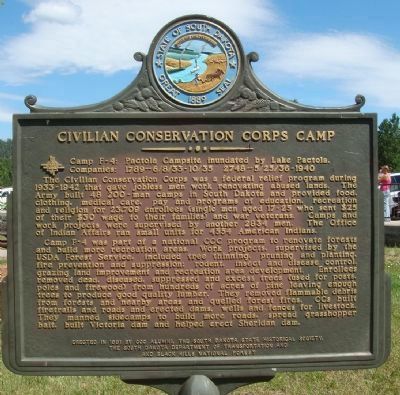
Civilian Conservation Corps Camp
The Civilian Conservation Corps was a federal relief program during 1933-1942 that gave jobless men work renovating abused lands. The Army built 48 200-man camps in South Dakota and provided food, clothing, medical care, pay and programs of education, recreation and religion for 23,709 enrollees (single men aged 17-25 who sent $25 of their $30 wage to their families) and war veterans. Camps and work projects were supervised by another 2834 men. The Office of Indian Affairs ran small units for 4554 American Indians.
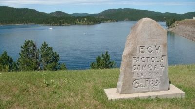
Camp F-4 was part of a national CCC program to renovate forests and build more recreational areas. Work projects, supervised by USDA Forest Service, included tree thinning, pruning and planting, fire prevention and suppression; rodent, insect and disease control; grazing land improvement and recreation area development. Enrollees removed dead, diseased, suppressed and excess trees (used for posts, poles and firewood) from hundreds of acres of pine leaving enough trees to produce good quality lumber. They removed flammable debris from forests and nearby areas and quelled forest fires. CCs built fire trails and roads and erected dams, wells and fences for livestock. They manned sidecamps to build more roads, spread grasshopper bait, built Victoria dam and helped erect Sheridan dam.
Erected 1991 by CCC Alumni, the South Dakota State Historical Society, the State Department of Transportation, and the Black Hills National Forest. (Marker Number 529.)
Topics and series. This historical marker is listed in this topic list: Charity & Public Work. In addition, it is included in the Civilian Conservation Corps (CCC), and the South Dakota State Historical Society Markers series lists.
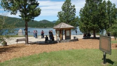
Location. 44° 4.141′ N, 103° 29.032′ W. Marker is near Johnson Siding, South Dakota, in Pennington County. Marker is on U.S. 385, 0.1 miles north of Custer Gulch Road, on the right when traveling south. The marker is at the visitor center for the Lake Pactola recreational area. Touch for map. Marker is in this post office area: Rapid City SD 57702, United States of America. Touch for directions.
Other nearby markers. At least 8 other markers are within 10 miles of this marker, measured as the crow flies. Pactola Dam & Reservoir (approx. half a mile away); Water for a Thirsty West (approx. half a mile away); a different marker also named Civilian Conservation Corps Camp (approx. 4.7 miles away); Historic Madison Ranch (approx. 6.8 miles away); Sheridan (approx. 7 miles away); a different marker also named Civilian Conservation Corps Camp
(approx. 7.2 miles away); Castleton (approx. 8˝ miles away); Explorer II (approx. 9.4 miles away). Touch for a list and map of all markers in Johnson Siding.
Related markers. Click here for a list of markers that are related to this marker. (other Civilian Conservation Corps Camp markers)
Additional keywords. Great Depression
Credits. This page was last revised on October 23, 2021. It was originally submitted on August 10, 2010, by William J. Toman of Green Lake, Wisconsin. This page has been viewed 1,119 times since then and 33 times this year. Last updated on October 22, 2021. Photos: 1, 2, 3, 4. submitted on August 10, 2010, by William J. Toman of Green Lake, Wisconsin. • J. Makali Bruton was the editor who published this page.


