Wharton Township near Farmington in Fayette County, Pennsylvania — The American Northeast (Mid-Atlantic)
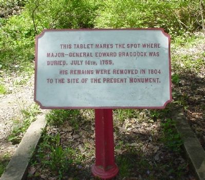
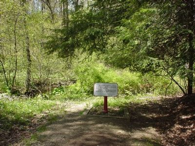
Braddock’s Original Grave Site
This tablet marks the spot where Major-General Edward Braddock was buried, July 14th, 1755,
His remains were removed in 1804 to the site of the present monument.
Topics and series. This historical marker is listed in these topic lists: Colonial Era • War, French and Indian. In addition, it is included in the Braddock’s Road and Maj. Gen. Edward Braddock series list. A significant historical date for this entry is July 14, 1806.
Location. 39° 49.974′ N, 79° 36.08′ W. Marker is near Farmington, Pennsylvania, in Fayette County. It is in Wharton Township. Marker can be reached from National Pike (U.S. 40) 1.2 miles east of Fayette Springs Road. Touch for map. Marker is in this post office area: Farmington PA 15437, United States of America. Touch for directions.
Other nearby markers. At least 8 other markers are within 2 miles of this marker, measured as the crow flies. Braddock’s Grave (within shouting distance of this marker); A Secret Grave (within shouting distance of this marker); Road to Disaster (about 300 feet away, measured in a direct line); Braddock Park (about 300 feet away); First Roads to the West (about 400 feet away); The Old Braddock Road (about 400 feet away); National Road (approx. 0.7 miles away); Fort Necessity (approx. 1.3 miles away). Touch for a list and map of all markers in Farmington.
Additional commentary.
1. Braddock's Expedition
General Braddock led an expedition of 2400 British soldiers, including Daniel Boone and Lieutenant Colonel George Washington, against the French at Fort Duquesne (now Pittsburgh). The expedition left from Columbia, Maryland on June 10, 1755, blazing a tortuous road through the Allegheny Mountains as they proceeded.
Braddock, although a brave soldier, had little understanding or respect for colonials, Native Americans, or their methods of warfare. After crossing the Monongahela River, Braddock's men were ambushed on July 9, 1755 by 900 French soldiers and Native American warriors. Braddock insisted on fighting out in the open, in traditional British "stand-up" style, and as a result about 70% of his force were wiped out. Braddock himself was mortally wounded.
Braddock asked his soldiers to leave him to die on the battlefield. His men refused, and carried him back along the trail they had blazed through Pennsylvania. While in transit, Braddock orchestrated the retreat of his troops and organized relief expeditions for other wounded soldiers. On July 13th Braddock died and was buried in the road. His soldiers continued their retreat the next morning, marching over his grave to obliterate all traces of it and spare it from desecration by the enemy.
The road that Braddock and his men blazed would later become the "National Road", which closely follows present-day U.S. Route 40. Decades after his death, his body was exhumed from this site and moved a couple hundred feet to its present location (see nearby marker, Braddock's Grave).
— Submitted January 30, 2008, by Kevin W. of Stafford, Virginia.
Credits. This page was last revised on February 7, 2023. It was originally submitted on May 9, 2006, by Phyllis Prats of Springfield, Virginia. This page has been viewed 4,179 times since then and 95 times this year. Last updated on February 15, 2021, by Carl Gordon Moore Jr. of North East, Maryland. Photos: 1, 2. submitted on May 9, 2006, by Phyllis Prats of Springfield, Virginia. • Bill Pfingsten was the editor who published this page.

