Near Middletown in Warren County, Virginia — The American South (Mid-Atlantic)
Frederick County / Shenandoah County
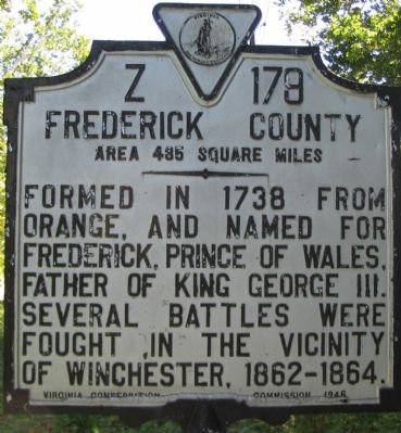
Frederick County. Area 485 Square Miles. Formed in 1738 from Orange, and named for Frederick, Prince of Wales, Father of King George III. Several battles were fought in the vicinity of Winchester, 1862-1864.
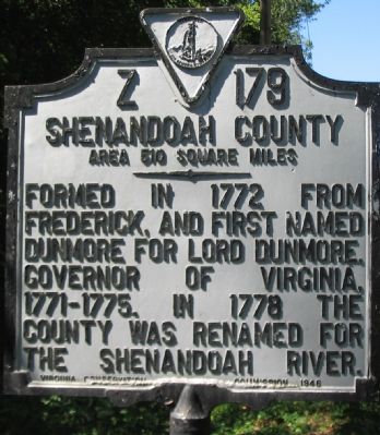
Shenandoah County. Area 510 Square Miles. Formed in 1772 from Frederick, and first named Dunmore for Lord Dunmore, Governor of Virginia, 1771-1775. In 1778 the county was renamed for the Shenandoah River.
Erected 1946 by Virginia Conservation Commission. (Marker Number Z-179.)
Topics and series. This historical marker is listed in these topic lists: Colonial Era • Political Subdivisions • Settlements & Settlers. In addition, it is included in the Virginia Department of Historic Resources (DHR) series list. A significant historical year for this entry is 1738.
Location. 39° 0.39′ N, 78° 18.978′ W. Marker is near Middletown, Virginia, in Warren County. Marker is on Valley Pike (U.S. 11), on the left when traveling south. Located just over the Ceder Creek Bridge, on the south bound lane of a short divided section of the Valley Pike. Touch for map. Marker is at or near this postal address: 8950 Valley Pike, Middletown VA 22645, United States of America. Touch for directions.
Other nearby markers. At least 8 other markers are within walking distance of this marker. Cedar Creek (approx. 0.2 miles away); a different marker also named Cedar Creek (approx. 0.2 miles away); Fort Bowman (approx. 0.2 miles away); 128th Regt N.Y.S.V.I. (approx. 0.4 miles away); Bearing the Brunt (approx. 0.4 miles away); Outflanked! (approx. 0.4 miles away); 128th New York Volunteer Regiment (approx. 0.4 miles away); Battle of Cedar Creek (approx. 0.4 miles away). Touch for a list and map of all markers in Middletown.
Additional commentary.
1. Location of the marker
The marker stands along a very short stretch of the roadway that very briefly cuts through Warren County. Therefore, the marker does not sit in either county that it describes.
— Submitted July 7, 2021, by Devry Becker Jones of Washington, District of Columbia.
Credits. This page was last revised on July 14, 2021. It was originally submitted on November 9, 2007, by Craig Swain of Leesburg, Virginia. This page has been viewed 1,093 times since then and 15 times this year. Photos: 1, 2, 3. submitted on November 9, 2007, by Craig Swain of Leesburg, Virginia.


