Gauley Bridge in Fayette County, West Virginia — The American South (Appalachia)
Battles For The Bridges
Gauley Bridge - A Town in Between
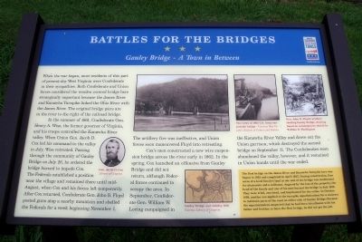
In the summer of 1861, Confederate Gen. Henry A. Wise, the former governor of Virginia, and his troops controlled the Kanawha River valley. When Union Gen. Jacob D. Cox led his command to the valley in July, Wise retreated. Passing through the community of Gauley Bridge on July 26, he ordered the bridge burned to impede Cox. The Federals established a position near the village and remained there until mid-August, when Cox and his forces left temporarily. After Cox returned, Confederate Gen. John B. Floyd posted guns atop a nearby mountain and shelled the Federals for a week beginning November 1. The artillery fire was ineffective, and Union forces soon maneuvered Floyd into retreating.
Cox’s men constructed a new wire suspension bridge across the river early in 1862. In the spring, Cox launched an offensive from Gauley Bridge and did not return, although Federal forces continued to occupy the area. In September, Confederate Gen. William W. Loring campaigned in the Kanawha River Valley and drove out the Union garrison, which destroyed the second bridge on September 11. The Confederates soon abandoned the valley, however, and it remained in Union hands until the war ended.
(sidebar)
The first bridge on the James River and Kanawha Turnpike here was begun in 1823 and completed in April 1825. During construction, four acres of a local family’s land at one end of the bridge was condemned for abutments and a tollhouse. Angered by the loss of the property, the head of the family and one of his sons burned the bridge in July 1826. They were tried, convicted, and imprisoned for the crime. In October 1830, another son applied to the turnpike superintendent for a contract to maintain parts of the road on either side of Gauley Bridge. Because the superintendent suspected that he had been in collusion with his father and brother to burn the first bridge, he did not get the job.
Erected by West Virginia Civil War Trails.
Topics and series. This historical marker is listed in these topic lists: Bridges & Viaducts • Roads & Vehicles • War, US Civil. In addition, it is included in the West Virginia Civil War Trails series list. A significant historical month for this entry is April 1825.
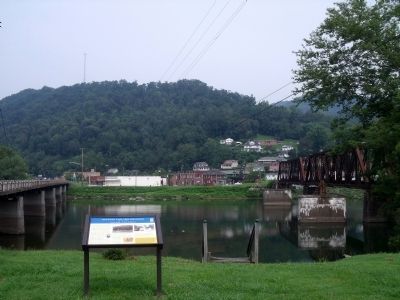
Location. This marker has been replaced by another marker nearby. It was located near 38° 9.752′ N, 81° 11.689′ W. Marker was in Gauley Bridge, West Virginia, in Fayette County. Marker was at the intersection of Midland Trail (U.S. 60) and Taylor Hill Road, on the right when traveling west on Midland Trail. Touch for map. Marker was in this post office area: Gauley Bridge WV 25085, United States of America. Touch for directions.
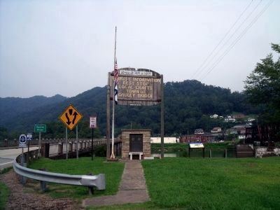
Other nearby markers. At least 8 other markers are within 5 miles of this location, measured as the crow flies. Gauley Bridge (here, next to this marker); Veterans Memorial (here, next to this marker); Less We Forget (here, next to this marker); a different marker also named Gauley Bridge (within shouting distance of this marker); Gauley Bridge War Memorial (approx. 0.2 miles away); Camp Reynolds (approx. 1.4 miles away); Christopher Q. Tompkins / Gauley Mount (approx. 2.1 miles away); Hawk's Nest Tunnel Disaster (approx. 4.6 miles away). Touch for a list and map of all markers in Gauley Bridge.
More about this marker. On the left is a portrait of "Gen. Jacob D. Cox" Library of Congress
On the top center are "Two views of 1862 U.S. Army suspension bridge — Courtesy West Virginia Division of Culture and History
On the bottom center is a map of "Gauley Bridge and vicinity, 1861" Courtesy Library of Congress
On the upper right is a drawing with the caption, "Gen. John B. Floyd’s artillery shelling Gauley Bridge, drawing based on contemporary sketch by William D. Washington"
Related marker. Click here for another marker that is related to this marker. New CWT Marker At This Location titled "Gauley Bridge".
Credits. This page was last revised on March 8, 2024. It was originally submitted on August 14, 2010, by Bernard Fisher of Richmond, Virginia. This page has been viewed 2,118 times since then and 86 times this year. Photos: 1, 2, 3. submitted on August 14, 2010, by Bernard Fisher of Richmond, Virginia. 4. submitted on September 11, 2010, by Becky Combs of Fayetteville, West Virginia.


