Near Wasco in Sherman County, Oregon — The American West (Northwest)
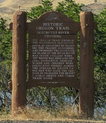
Deschutes River Crossing
Erected by Oregon Department of Transportation and Oregon Travel Information Council.
Topics and series. This historical marker is listed in these topic lists: Settlements & Settlers • Waterways & Vessels. In addition, it is included in the Oregon Beaver Boards, and the Oregon Trail series lists.
Location. 45° 38.049′ N, 120° 54.715′ W. Marker is near Wasco, Oregon, in Sherman County. Marker is on Biggs-Rufus Highway (Oregon Route 206) ¼ mile east of Moody Road (County Road 143), on the right when traveling west. The marker is located on Sherman County side of the Biggs-Rufus Highway bridge over the Deschutes River. Touch for map. Marker is in this post office area: Wasco OR 97065, United States of America. Touch for directions.
Other nearby markers. At least 8 other markers are within 3 miles of this marker, measured as the crow flies. Deschutes River Crossing Oregon Trail Kiosk (approx. ¼ mile away); Ancient Indian Fishing Grounds (approx. 2.6 miles away); Greatest Indian Fishery of the Northwest (approx. 2.6 miles away); The Lewis and Clark Expedition (approx. 2.6 miles away); Celilo Falls Fishing Grounds (approx. 2.6 miles away); View of Mount Jefferson (approx. 2.9 miles away in Washington); Celilo Falls (approx. 2.9 miles away in Washington); Wyam (approx. 2.9 miles away in Washington).

Photographed By Paul Crumlish, August 1, 2010
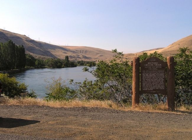
2. Wide view of the Deschutes River Crossing Marker
Looking upstream across the primary stretch of river forded by settlers on the Oregon Trail. Today the area is now the Deschutes River State Recreation Area, on the eastern edge of the Columbia River Gorge National Scenic Area.
Credits. This page was last revised on February 11, 2018. It was originally submitted on August 19, 2010, by PaulwC3 of Northern, Virginia. This page has been viewed 1,534 times since then and 42 times this year. Photos: 1, 2. submitted on August 19, 2010, by PaulwC3 of Northern, Virginia.
