Lead in Lawrence County, South Dakota — The American Midwest (Upper Plains)
Homestake Open Cut Mine
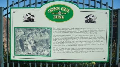
Two noteworthy expansions of the Open Cut occurred in the 1980's -- the first in the north end and the second and much larger expansion toward the south. Both projects employed conventional open pit mining methods involving drilling, blasting, and hauling. Haul trucks capable of holding 85 tons of material were used to move the ore to a mill for processing. Left behind was waste rock -- rock with no economic value -- that had to be moved to access the gold ore. The Open Cut is 1200 feet deep and one-half mile wide. In open pit mines such as the Open Cut, waste rock is stacked in waste rock facilities and then reclaimed (restored to beneficial use).
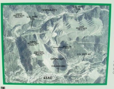
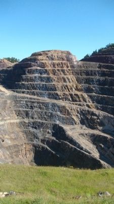
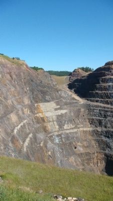
Of the three peaks seen here, the Bobtail and Highland are waste rock facilities, while Rhyolite Peak -- with its bands of light and dark rock -- is Mother Nature's work, and may be up to two billion years old. Two additional waste rock facilities are located near the Open Cut but unseen from this view -- the East and Sawpit.
Topics. This historical marker is listed in these topic lists: Industry & Commerce • Natural Resources. A significant historical year for this entry is 1876.
Location. 44° 21.135′ N, 103° 45.824′ W. Marker is in Lead, South Dakota, in Lawrence County. Marker can be reached from the intersection of West Main Street (U.S. 85) and Bleeker Street, on the left when traveling east. Touch for map. Marker is at or near this postal address: 160 West Main Street, Lead SD 57754, United States of America. Touch for directions.
Other nearby markers. At least 8 other markers are within walking distance of this marker. The Homestake Gold Mine and Open Cut (within shouting distance of this marker); The Open Cut (within shouting distance of this marker); Ray Davis and the Homestake Experiment (within shouting distance of this marker); Sweatman Art Memorial / Finnish Lutheran Church (within shouting distance of this marker); Homestake Gas-Powered Locomotive (about 300 feet away, measured in a direct line); Pneumatic Rock Drill (about 400 feet away); The First National (Norwest) Bank (about 500 feet away); Homestake One Ton, End Dump Ore Car (about 600 feet away). Touch for a list and map of all markers in Lead.
Photographed By William J. Toman, August 10, 2010
5. Related Marker: General Cross Section of the Mine
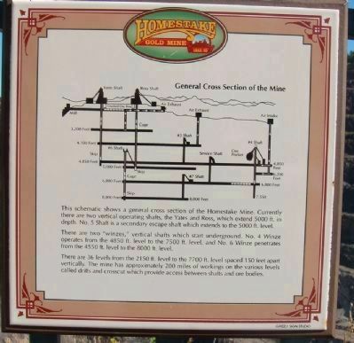
Text:The schematic shows a general cross section of the Homestake Mine. Currently there are two vertical operating shafts, the Yates and Ross, which extend 5000 ft. in depth. No. 5 Shaft is a secondary escape shaft which extends to the 5000 ft. level.
There are two "winzes," vertical shafts which start underground. No. 4 Winze operates from the 4850 ft. level to the 7500 ft. level, and No. 6 Winze penetrates from the 4550 ft. level to the 8000 ft. level.
There are 36 levels from the 2150 ft. level to the 7700 ft. level spaced 150 feet apart vertically. The mine has approximately 200 miles of workings on the various levels called drifts and crosscut which provide access between shafts and ore bodies.
Photographed By William J. Toman, August 10, 2010
6. Related Marker: Homestake and the Environment
Text: Mining and associated processing activities, by their nature, involve disturbance and use of land and resources.
Homestake is committed to conducting activities in an environmentally sound manner, minimizing impacts to the environment through innovative facility design, mitigation practices, and the implementation of proven environmental control procedures. Sound environmental practices allow Homestake to produce a mineral which is essential to the existence of modern and productive society.
An example of Homestake's commitment to the environment is demonstrated at the wastewater treatment plant. Here, a biological process, designed by Homestake scientists, is used to treat mine process water. The water is treated to meet or exceed all state and federal water quality standards and is discharged into Gold Run Creek. The creek is a viable cold water fishery.
Photographed By William J. Toman, August 10, 2010
7. Related Marker: Open Cut Mining Process
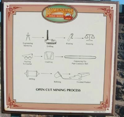
The marker shows the process from engineering and surveying to drilling, to blasting, to assaying, to hauling to crusher, to crushing, to conveying via pipe conveyor belt, to milling, to refining, to finished product.
Credits. This page was last revised on June 16, 2016. It was originally submitted on August 21, 2010, by William J. Toman of Green Lake, Wisconsin. This page has been viewed 2,366 times since then and 57 times this year. Photos: 1, 2, 3, 4. submitted on August 21, 2010, by William J. Toman of Green Lake, Wisconsin. 5, 6, 7. submitted on August 22, 2010, by William J. Toman of Green Lake, Wisconsin. • Bill Pfingsten was the editor who published this page.
