Greenfield in Milwaukee County, Wisconsin — The American Midwest (Great Lakes)
Greenfield: The Last Town in Milwaukee County
Inscription.
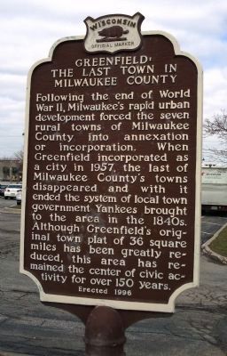
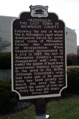
Following the end of World War II, Milwaukee’s rapid urban development forced the seven rural towns of Milwaukee County into annexation or incorporation. When Greenfield incorporated as a city in 1957, the last of Milwaukee County’s towns disappeared and with it ended the system of local town government Yankees brought to the area in the 1840s. Although Greenfield’s original plat of 36 square miles has been greatly reduced, this area has remained the center of civic activity for over 150 years.
Erected 1996 by Wisconsin State Historical Society. (Marker Number 341.)
Topics and series. This historical marker is listed in this topic list: Settlements & Settlers. In addition, it is included in the Wisconsin Historical Society series list. A significant historical year for this entry is 1957.
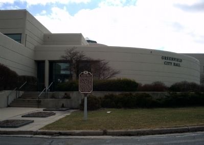
Location. 42° 57.945′ N, 88° 0.23′ W. Marker is in Greenfield, Wisconsin, in Milwaukee County. Marker can be reached from W. Forest Home Ave. Marker is in front of City Hall. Touch for map. Marker is at or near this postal address: 7325 W Forest Home Ave, Milwaukee WI 53220, United States of America. Touch for directions.
Other nearby markers. At least 8 other markers are within 2 miles of this marker, measured as the crow flies. Bodamer Log Cabin (approx. 1.1 miles away); The Land Survey of 1836 / Greenfield’s 1836 Greenery (approx. 1.4 miles away); Janesville Plank Road (approx. 1.6 miles away); Village of Greendale (approx. 1.6 miles away); Greendale's 'Backward Houses' (approx. 1.7 miles away); "Rockwell Plaza" (approx. 1.7 miles away); Memorial Church (approx. 1.7 miles away); This Historic Two-Story Building Was Built In 1938 (approx. 1.7 miles away). Touch for a list and map of all markers in Greenfield.
Credits. This page was last revised on June 16, 2016. It was originally submitted on August 23, 2010, by Paul Fehrenbach of Germantown, Wisconsin. This page has been viewed 984 times since then and 31 times this year. Photos: 1, 2, 3. submitted on August 23, 2010, by Paul Fehrenbach of Germantown, Wisconsin. • Bill Pfingsten was the editor who published this page.


